Back Цылертальскія Альпы Byelorussian Цилерталски Алпи Bulgarian Alpi Aurine CEB Zillertalské Alpy Czech Zillertal-Alperne Danish Zillertaler Alpen German Alpes de Zillertal Spanish Zillertali Alpid Estonian Zillertalin Alpit Finnish Alpes de Zillertal French
| Zillertal Alps | |
|---|---|
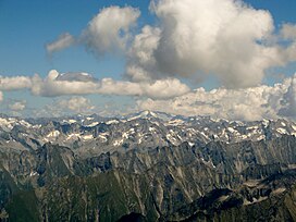
 The Zillertal Alps | |
| Highest point | |
| Peak | Hochfeiler |
| Elevation | 3,510 m (11,520 ft) |
| Coordinates | 46°58′22″N 11°43′34″E / 46.97278°N 11.72611°E |
| Geography | |
| Countries | Austria and Italy |
| States | Tyrol, Salzburg and South Tyrol |
| Range coordinates | 47°00′N 11°55′E / 47.000°N 11.917°E |
| Parent range | Central Eastern Alps |
The Zillertal Alps (Italian: Alpi Aurine; German: Zillertaler Alpen) are a mountain range of the Central Eastern Alps on the border of Austria and Italy.
© MMXXIII Rich X Search. We shall prevail. All rights reserved. Rich X Search
