Back صن شاين كوست Arabic سانشاین کوست، کوئینزلند AZB Саншайн-Кост Byelorussian Съншайн Коуст Bulgarian Sunshine Coast Catalan سانشاین کۆست، کوینزلەند CKB Sunshine Coast Danish Sunshine Coast (Queensland) German Sunshine Coast, Queensland English Sunbrila Bordo Esperanto
| Sunshine Coast Queensland | |||||||||
|---|---|---|---|---|---|---|---|---|---|
|
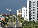
The Glass House Mountains from Mary Cairncross Reserve; Hastings Street at Noosa Heads, Maroochydore's urban centre; Rainbow Beach, Currimundi Beach in Caloundra; The Big Cow in Nambour, Steve Irwin at Australia Zoo | |||||||||
 | |||||||||
| Coordinates | 26°39′S 153°04′E / 26.650°S 153.067°E | ||||||||
| Population | 302,122 (2015)[1] (9th) | ||||||||
| • Density | 185.01/km2 (479.2/sq mi) | ||||||||
| Area | 1,633 km2 (630.5 sq mi)[2] (2011 urban) | ||||||||
| Location | 100 km (62 mi) from Brisbane | ||||||||
| LGA(s) | |||||||||
| State electorate(s) | Buderim, Caloundra, Glass House, Kawana, Maroochydore, Nicklin, Noosa | ||||||||
| Federal division(s) | |||||||||
| |||||||||
The Sunshine Coast (population 312,908) is a coastal region in South East Queensland, north of the Queensland capital of Brisbane. On 15 March 2008, the former Councils of Noosa Shire, Maroochy Shire and Caloundra City combined to form the Sunshine Coast Regional Council.
The Sunshine Coast is bordered by the Pacific Ocean in the east, and extends to the local government boundaries beyond the Blackall Range to the west. Sometimes, the towns of Gympie, which is 30 minutes' drive north of Noosa Heads, and Caboolture, 30 minutes' drive south of Caloundra, have been included in a broader definition of the Sunshine Coast region.
- ↑ "3218.0 – Regional Population Growth, Australia, 2014–15: Population Estimates by Significant Urban Area, 2005 to 2015". Australian Bureau of Statistics. Australian Bureau of Statistics. 30 March 2016. Archived from the original on 8 September 2016. Retrieved 12 September 2016. Estimated resident population, 30 June 2015.
- ↑ "2011 Census Community Profiles: Sunshine Coast". ABS Census. Australian Bureau of Statistics. Archived from the original on 7 November 2017. Retrieved 15 September 2016.
© MMXXIII Rich X Search. We shall prevail. All rights reserved. Rich X Search


