Back 59th Street (Manhattan) German Calle 59 (Manhattan) Spanish 59th Street Estonian 59. kalea (Manhattan) Basque 59e Rue French רחוב 59 HE 59丁目 (マンハッタン) Japanese 59-я улица (Манхэттен) Russian 59-та вулиця (Мангеттен) Ukrainian 59街 Chinese
40°45′51″N 73°58′23″W / 40.7642908724°N 73.9730390°W
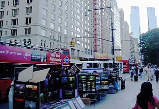
 Looking west along Central Park South | |
 | |
| West end | Twelfth Avenue |
|---|---|
| Major junctions | Grand Army Plaza, Columbus Circle |
| East end | Sutton Place |
59th Street is a crosstown street in the New York City borough of Manhattan, running from York Avenue and Sutton Place on the East Side of Manhattan to the West Side Highway on the West Side. The three-block portion between Columbus Circle and Grand Army Plaza is known as Central Park South, since it forms the southern border of Central Park. There is a gap in the street between Ninth Avenue/Columbus Avenue and Columbus Circle, where the Deutsche Bank Center is located. While Central Park South is a bidirectional street, most of 59th Street carries one-way traffic.
59th Street forms the border between Midtown Manhattan and Upper Manhattan. North of 59th Street, the neighborhoods of the Upper West Side and Upper East Side continue on either side of Central Park. On the West Side, Manhattan's numbered avenues are renamed north of 59th Street: Eighth Avenue (at Columbus Circle) becomes Central Park West; Ninth Avenue is renamed Columbus Avenue; Tenth Avenue is renamed Amsterdam Avenue; and Eleventh Avenue becomes West End Avenue.
© MMXXIII Rich X Search. We shall prevail. All rights reserved. Rich X Search