Back مقاطعة غرافتون (نيوهامشير) Arabic Grafton County, New Hampshire BAR Графтън (окръг, Ню Хампшър) Bulgarian গ্রফটন কাউন্টি, নিউ হ্যাম্পশায়ার BPY Grafton Gông (New Hampshire) CDO Графтон (гуо, Нью-Гэмпшир) CE Grafton County CEB Grafton County Czech Grafton County, New Hampshire Welsh Grafton County German
Grafton County | |
|---|---|
 Grafton County Courthouse in Haverhill | |
 Location within the U.S. state of New Hampshire | |
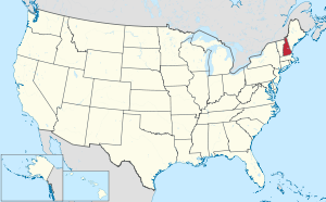
 New Hampshire's location within the U.S. | |
| Coordinates: 43°53′46″N 71°53′41″W / 43.896069°N 71.89463°W | |
| Country | |
| State | |
| Founded | 1769 |
| Named for | Augustus FitzRoy, 3rd Duke of Grafton |
| Seat | Haverhill |
| Largest city | Lebanon |
| Area | |
| • Total | 1,749.7 sq mi (4,532 km2) |
| • Land | 1,708.6 sq mi (4,425 km2) |
| • Water | 41.1 sq mi (106 km2) 2.3% |
| Population (2020) | |
| • Total | 91,118 |
| • Estimate (2022) | 91,126 |
| • Density | 53.3/sq mi (20.6/km2) |
| Time zone | UTC−5 (Eastern) |
| • Summer (DST) | UTC−4 (EDT) |
| Congressional districts | 1st, 2nd |
| Website | www |
Grafton County is a county in the U.S. state of New Hampshire. As of the 2020 census, the population was 91,118.[1] Its county seat is the town of Haverhill.[2] In 1972, the county courthouse and other offices were moved from Woodsville, a larger village within the town of Haverhill, to North Haverhill.
Grafton County is part of the Claremont-Lebanon, NH–VT Micropolitan Statistical Area.
The county is the home of Dartmouth College and Plymouth State University. Progressive Farmer rated Grafton County fourth in its list of the "Best Places to Live in Rural America" in 2006,[3] citing low unemployment (despite slow economic growth), a favorable cost of living, and the presence of White Mountain National Forest, the state's only national forest.
- ^ "State & County QuickFacts". United States Census Bureau. Retrieved January 14, 2024.
- ^ "Find a County". National Association of Counties. Archived from the original on May 31, 2011. Retrieved June 7, 2011.
- ^ "Progressive Farmer's top counties for country living - Feb. 2, 2006". money.cnn.com. Retrieved June 5, 2020.
© MMXXIII Rich X Search. We shall prevail. All rights reserved. Rich X Search