North Terrace | |
|---|---|
 | |
| North Terrace facing west in the early evening | |
 | |
| Coordinates | |
| General information | |
| Type | Street |
| Location | Adelaide city centre |
| Length | 2.1 km (1.3 mi)[1] |
| Opened | 1837 |
| Major junctions | |
| West end | West Terrace Port Road Adelaide |
| East end | East Terrace Botanic Road Adelaide |
| Location(s) | |
| LGA(s) | City of Adelaide |
| ---- | |


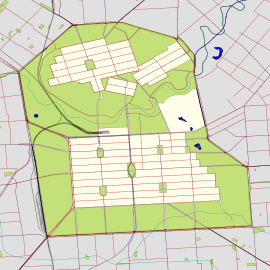
North Terrace is one of the four terraces that bound the central business and residential district of Adelaide, the capital city of South Australia. It runs east–west, along the northern edge of "the square mile". The western end continues on to Port Road, and the eastern end continues across the Adelaide Parklands as Botanic Road.[2][3]
- ^ Google (30 May 2022). "North Terrace" (Map). Google Maps. Google. Retrieved 30 May 2022.
- ^ 2003 Adelaide Street Directory, 41st Edition. UBD. 2003. ISBN 0-7319-1441-4.
- ^ Map of the Adelaide city centre, North Adelaide and the Adelaide Park Lands.
© MMXXIII Rich X Search. We shall prevail. All rights reserved. Rich X Search

