Back بيتربورو (نيوهامشير) Arabic بيتربورو ARZ Peterborough (Nou Hampshire) Catalan Питерборо (Нью-Гэмпшир) CE Peterborough (lungsod sa Tinipong Bansa) CEB Peterborough, New Hampshire Welsh Peterborough (New Hampshire) German Peterborough (Nuevo Hampshire) Spanish Peterborough (New Hampshire) Basque پیتربورو، نیوهمپشایر Persian
Peterborough, New Hampshire | |
|---|---|
Town | |
 Town House, built in 1918 | |
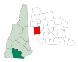
 Location in Hillsborough County, New Hampshire | |
| Coordinates: 42°52′14″N 71°57′06″W / 42.87056°N 71.95167°W | |
| Country | United States |
| State | New Hampshire |
| County | Hillsborough |
| Incorporated | 1760 |
| Villages | Peterborough Happy Valley Noone North Village West Peterborough |
| Government | |
| • Select Board | Tyler Ward, Chair William Taylor William Kennedy |
| • Town Administrator | Nicole MacStay |
| Area | |
| • Total | 38.43 sq mi (99.53 km2) |
| • Land | 38.02 sq mi (98.47 km2) |
| • Water | 0.41 sq mi (1.06 km2) 1.06% |
| Elevation | 718 ft (219 m) |
| Population (2020)[2] | |
| • Total | 6,418 |
| • Density | 169/sq mi (65.2/km2) |
| Time zone | UTC−5 (Eastern) |
| • Summer (DST) | UTC−4 (Eastern) |
| ZIP Code | 03458 |
| Area code | 603 |
| FIPS code | 33-60580 |
| GNIS feature ID | 0873697 |
| Website | www |
Peterborough is a town in Hillsborough County, New Hampshire, United States. The population was 6,418 at the 2020 census.[2] The main village, with 3,090 people at the 2020 census, is defined as the Peterborough census-designated place (CDP) and is located along the Contoocook River at the junction of U.S. Route 202 and New Hampshire Route 101. Peterborough is 38 miles (61 km) west of Manchester and 72 miles (116 km) northwest of Boston.
- ^ "2021 U.S. Gazetteer Files – New Hampshire". United States Census Bureau. Retrieved December 9, 2021.
- ^ a b "Peterborough town, Hillsborough County, New Hampshire: 2020 DEC Redistricting Data (PL 94-171)". U.S. Census Bureau. Retrieved December 9, 2021.
© MMXXIII Rich X Search. We shall prevail. All rights reserved. Rich X Search
