Back كاريزو سبرينغز Arabic كاريزو سبرينجز ARZ کریزو اسپرینقز، تکزاس AZB Карыза-Спрынгс Byelorussian Карризо-Спрингс (Техас) CE Carrizo Springs (kapital sa kondado) CEB Carrizo Springs, Texas Welsh Carrizo Springs German Carrizo Springs Spanish Carrizo Springs (Texas) Basque
Carrizo Springs, Texas | |
|---|---|
 Carrizo Springs water tower | |
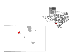
 Location in the state of Texas | |
 | |
| Coordinates: 28°31′36″N 99°51′45″W / 28.52667°N 99.86250°W | |
| Country | United States |
| State | Texas |
| County | Dimmit |
| Government | |
| • Mayor | Dina Ojeda-Balderas |
| Area | |
| • Total | 3.10 sq mi (8.03 km2) |
| • Land | 3.09 sq mi (8.00 km2) |
| • Water | 0.01 sq mi (0.03 km2) |
| Elevation | 604 ft (184 m) |
| Population (2010) | |
| • Total | 5,368 |
| • Estimate (2019)[3] | 5,362 |
| • Density | 1,735.28/sq mi (669.90/km2) |
| Time zone | UTC-6 (CST) |
| • Summer (DST) | UTC-5 (CDT) |
| ZIP code | 78834 |
| Area code | 830 |
| FIPS code | 48-12988[4] |
| GNIS feature ID | 1372953[2] |
| Website | cityofcarrizo.org |
Carrizo Springs is the largest city in and the county seat of Dimmit County, Texas, United States.[5] The population was 5,368 at the 2010 census. (2018 estimate 5,470).[6]
The name of the town is derived from the local springs, which were named by the Spanish for the cane grass that once grew around them. It is the oldest town in Dimmit County. Artesian wells in the area are known for their pure, clean water. This water is often exported from Carrizo Springs for use as holy water.
- ^ "2019 U.S. Gazetteer Files". United States Census Bureau. Retrieved August 7, 2020.
- ^ a b U.S. Geological Survey Geographic Names Information System: Carrizo Springs, Texas
- ^ "Population and Housing Unit Estimates". United States Census Bureau. May 24, 2020. Retrieved May 27, 2020.
- ^ "U.S. Census website". United States Census Bureau. Retrieved January 31, 2008.
- ^ "Find a County". National Association of Counties. Archived from the original on May 31, 2011. Retrieved June 7, 2011.
- ^ https://www.census.gov/ [not specific enough to verify]
© MMXXIII Rich X Search. We shall prevail. All rights reserved. Rich X Search