Back قولدز، فلوریدا AZB Goulds Catalan Гулдс (Флорида) CE Goulds CEB Goulds (Florida) German Goulds Spanish Goulds (Florida) Basque گولدز، فلوریدا Persian Goulds (Floride) French Goulds Italian
Goulds, Florida | |
|---|---|
 Location in Miami-Dade County and the state of Florida | |
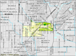
 U.S. Census Bureau map showing CDP boundaries | |
| Coordinates: 25°33′39″N 80°23′0″W / 25.56083°N 80.38333°W | |
| Country | |
| State | |
| County | |
| Area | |
| • Total | 2.93 sq mi (7.58 km2) |
| • Land | 2.91 sq mi (7.53 km2) |
| • Water | 0.02 sq mi (0.05 km2) |
| Elevation | 10 ft (3 m) |
| Population | |
| • Total | 11,446 |
| • Density | 3,934.69/sq mi (1,519.21/km2) |
| Time zone | UTC-5 (Eastern (EST)) |
| • Summer (DST) | UTC-4 (EDT) |
| ZIP code | 33170 |
| Area code(s) | 305, 786, 645 |
| FIPS code | 12-26950[3] |
| GNIS feature ID | 0283239[4] |
Goulds is an unincorporated community and census-designated place (CDP) in Miami-Dade County, Florida, United States. The area was originally populated as the result of a stop on the Florida East Coast Railroad. The railroad depot was located near the current Southwest 224th Street. The community was named after its operator, Lyman Gould, who cut trees for railroad ties. It is part of the Miami metropolitan area of South Florida. As of the 2020 US census, the population stood at 11,446,[2] up from 10,103 in 2010 US census.
- ^ "2022 U.S. Gazetteer Files: Florida". United States Census Bureau. Retrieved January 9, 2023.
- ^ a b "P1. Race – Goulds CDP, Florida: 2020 DEC Redistricting Data (PL 94-171)". U.S. Census Bureau. Retrieved January 9, 2023.
- ^ "U.S. Census website". United States Census Bureau. Retrieved January 31, 2008.
- ^ "US Board on Geographic Names". United States Geological Survey. October 25, 2007. Retrieved January 31, 2008.
© MMXXIII Rich X Search. We shall prevail. All rights reserved. Rich X Search