Back Grand Coulee Catalan Grand Coulee (walog sa Tinipong Bansa, Washington, Grant County, lat 47,39, long -119,49) CEB Grand Coulee (Landschaft) German Grand Coulee Esperanto Grand Coulee Spanish Grand Coulee Basque Grand Coulee Finnish Grand Coulee French גרנד קולי HE Grand Coulee Hungarian
| Grand Coulee | |
|---|---|
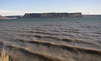
 Grand Coulee, below Dry Falls. The layering effect of periodic basalt lava flows is visible. | |
Map of Washington state | |
| Location | Washington state |
| Coordinates | 47°37′12″N 119°18′27″W / 47.62°N 119.3075°W |
| Designated | 1965 |


Grand Coulee is an ancient river bed in the U.S. state of Washington. This National Natural Landmark[1] stretches for about 60 miles (100 km) southwest from Grand Coulee Dam to Soap Lake, being bisected by Dry Falls into the Upper and Lower Grand Coulee.
- ^ "Grand Coulee". nps.gov. National Park Service. Archived from the original on 2013-03-08. Retrieved 2013-03-31.
© MMXXIII Rich X Search. We shall prevail. All rights reserved. Rich X Search
