Back Hochrhein ALS Hochrhein German Alta Rejno Esperanto Haut-Rhin (hydrologie) French 하이라인강 Korean Hochrhein NN Hochrhein NB Hochrhein Romanian Высокий Рейн Russian Yukarı Ren Turkish

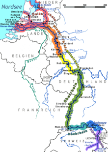
The High Rhine (German: Hochrhein, pronounced [ˈhoːxˌʁaɪn] ⓘ) is the name used for the part of the Rhine that flows westbound from Lake Constance to Basel. The High Rhine begins at the outflow of the Rhine from the Untersee in Stein am Rhein and turns into the Upper Rhine in Basel. In contrast to the Alpine Rhine and Upper Rhine, the High Rhine flows mostly to the west.
The section is marked by Rhine-kilometers 0 to 165, measurements beginning at the outflow of the Obersee at the Old Rhine Bridge in Constance. It is the first of four sections (High Rhine, Upper Rhine, Middle Rhine, Lower Rhine) of the Rhine between Lake Constance and the North Sea. In the western part, the Rhine marks the border between Germany and Switzerland, while in the eastern part, Switzerland owns areas north of the Rhine and surrounds the popular German holiday resort of Büsingen am Hochrhein.

The term High Rhine was introduced by scientists in the 19th century.[citation needed]
Above all geologists tried to differentiate the High Rhine (Hochrhein) linguistically from the Upper Rhine (German: Oberrhein). Until the 19th century, it was also known as the "Badisch-Swiss Rhine".[1]
- ^ Reinhard Valenta: Eine Landschaft im Wandel; Der Hochrhein zwischen Waldshut und Rheinfelden. in: Bosch, M. A. Enderle, H. Fricker & R. Valenta: Der Hochrhein. G.Braun Verlag, Karlsruhe, 1997, p.6-29
© MMXXIII Rich X Search. We shall prevail. All rights reserved. Rich X Search