Back منطقة بوروليا Arabic مديريه بوروليا ARZ पुरुलिया जिला Bihari পুরুলিয়া জেলা Bengali/Bangla Purulia (Distrikt) German Distrito de Purulia Spanish Purulia barrutia Basque بخش پورولیا Persian District de Purulia French पुरुलिया जिला Hindi
Purulia district | |
|---|---|
|
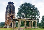
Clockwise from top-left: Joychandi Pahar, Banda Deul temple, Ajodhya Hills, Winding hill-road, Chhau dance | |
 Location of Purulia in West Bengal | |
| Coordinates: 23°20′N 86°22′E / 23.333°N 86.367°E | |
| Country | India |
| State | West Bengal |
| Division | Medinipur |
| Headquarters | Purulia |
| Government | |
| • Lok Sabha constituencies |
|
| • Vidhan Sabha constituencies | Bandwan, Balarampur, Baghmundi, Joypur, Purulia, Manbazar, Kashipur, Para, Raghunathpur |
| Area | |
| • Total | 6,259 km2 (2,417 sq mi) |
| Population (2011) | |
| • Total | 2,930,115 |
| • Density | 470/km2 (1,200/sq mi) |
| Demographics | |
| • Literacy | 74.48% |
| • Sex ratio | 955/1000 |
| Time zone | UTC+05:30 (IST) |
| Average annual precipitation | 1100 - 1500 mm |
| Website | purulia |
Purulia district (Pron: puruliːaː) is one of the twenty-three districts of West Bengal state in Eastern India. Purulia is the administrative headquarters of the district. Some of the other important towns of Purulia district are Raghunathpur-Adra, Jhalda, Anara and Balarampur.
© MMXXIII Rich X Search. We shall prevail. All rights reserved. Rich X Search


