Back Ciudá de St. Albans AST City and District of St. Albans CEB Dinas ac Ardal St Albans Welsh City and District of St Albans German Distrito de St. Albans Spanish Cité de St Albans French City of St Albans FRR Città e distretto di St Albans Italian シティ・オブ・セント・オールバンズ Japanese 시티오브세인트올번스 Korean
City and District of St Albans | |
|---|---|
| St Albans | |
 | |
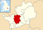
 St Albans shown within Hertfordshire | |
| Sovereign state | United Kingdom |
| Country | England |
| Region | East of England |
| Non-metropolitan county | Hertfordshire |
| Status | Non-metropolitan district, Borough, City |
| Admin HQ | St Albans |
| Incorporated | 1 April 1974 |
| Government | |
| • Type | Non-metropolitan district council |
| • Body | St Albans City and District Council |
| • Leadership | Leader & Committee Structure |
| • MPs | Daisy Cooper (LD) Bim Afolami (C) |
| Area | |
| • Total | 62.23 sq mi (161.18 km2) |
| • Rank | 177 (of 296) |
| Population (2022) | |
| • Total | 147,095[1] |
| • Rank | 141 (of 296) |
| Ethnicity (2021) | |
| • Ethnic groups | |
| Religion (2021) | |
| • Religion | List
|
| Time zone | UTC0 (GMT) |
| • Summer (DST) | UTC+1 (BST) |
| ONS code | 26UG (ONS) E07000100 (GSS) |
| OS grid reference | TL148073 |
St Albans (/ˈɔːlbənz/),[3] also known as the City and District of St Albans, is a local government district with city status in Hertfordshire, England. Its council is based in St Albans, the largest settlement in the district. The district also includes the town of Harpenden and several villages. The district borders North Hertfordshire, Welwyn Hatfield, Hertsmere, Watford, Three Rivers, Dacorum, and Central Bedfordshire.
- ^ "Population estimates - Office for National Statistics". Archived from the original on 25 May 2017. Retrieved 29 June 2019.
- ^ a b UK Census (2021). "2021 Census Area Profile – St Albans Local Authority (E07000240)". Nomis. Office for National Statistics. Retrieved 5 January 2024.
- ^ "Local Authority Districts, Counties and Unitary Authorities (April 2021) Map in United Kingdom". Office for National Statistics: Open Geography Portal. Retrieved 1 August 2023.
© MMXXIII Rich X Search. We shall prevail. All rights reserved. Rich X Search
