Back Johor Bahru Afrikaans جوهر بهرو Arabic Johor Bahru AST Cohor Baru Azerbaijani جوهور باهرو AZB Джахор-Бару Byelorussian Джохор Бахру Bulgarian Juhur Bahru, Malaysia BJN জোহর বাহরু Bengali/Bangla Johor Bahru Catalan
Johor Bahru | |
|---|---|
| City of Johor Bahru Bandaraya Johor Bahru | |
| Other transcription(s) | |
| • Jawi | جوهر بهارو |
| • Chinese | 新山 (Simplified) 新山 (Traditional) Xīnshān (Hanyu Pinyin) |
| • Tamil | ஜொகூர் பாரு Jokūr Pāru (Transliteration) |
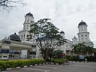
From top, left to right: Downtown skyline at night, Johor-Singapore Causeway and Johor Bahru Sentral the transport hub in Southern Integrated Gateway, Skyline of the city centre, Forest City (Hutan Bandar) Recreational Park, Danga Bay, the Sultan Ibrahim Building, the Sultan Abu Bakar Mosque, and the Figure Museum | |
| Nickname(s): JB, Bandaraya Selatan (Southern City) | |
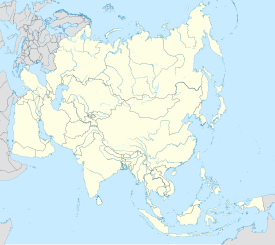
Location of Johor Bahru in Johor | |
| Coordinates: 01°27′20″N 103°45′40″E / 1.45556°N 103.76111°E | |
| Country | |
| State | |
| District | |
| Administrative areas | List |
| Founded | 10 March 1855 (as Tanjung Puteri) |
| Establishment of the local government | 1933 |
| Establishment of the Town Board | 1950 |
| Municipality status | 1 April 1977 |
| City status | 1 January 1994 |
| Government | |
| • Type | City council |
| • Body | Johor Bahru City Council |
| • Mayor | Noorazam Osman |
| Area | |
| • Total | 391.25 km2 (151.06 sq mi) |
| Elevation | 32 m (105 ft) |
| Population (2020)[3] | |
| • Total | 858,118 |
| • Density | 2,192/km2 (5,680/sq mi) |
| Demonym | Johor Bahru |
| Time zone | UTC+8 (MST) |
| • Summer (DST) | UTC+8 (Not observed) |
| Postal code | 80xxx to 81xxx |
| Area code(s) | 07 |
| Vehicle registration | J |
| Website | www |
Johor Bahru (Malaysian: [ˈdʒohor ˈbahru]), colloquially referred to as JB, is the capital city of the state of Johor, Malaysia and the core city of Johor Bahru District, the second largest district in Malaysia by population.[4] It is the second-largest GDP contributor among all major cities in Malaysia,[5] and forms a part of Iskandar Malaysia, the nation's largest special economic zone by investment value.[6] The city has a population of 858,118 people within an area of 391.25 km2.
As the financial centre and logistics hub of southern Peninsular Malaysia, Johor Bahru has been ranked the second-most competitive city in the nation, behind only Kuala Lumpur.[7] Geographically, it is located at the southern end of Peninsular Malaysia, along the north bank of the Straits of Johor, opposite the city-state Singapore. The city serves as one of the two land border connections on the Malaysian side between Singapore and Malaysia, the other being the Second Link at Iskandar Puteri. It is the busiest international border crossing in the world; its direct land link to the city-state through the causeway and the RTS Link is a key economic driver of the border city. Johor Bahru is categorised as Zone A of Iskandar Malaysia and is adjacent to Senai International Airport and the 16th-busiest port in the world, Port of Tanjung Pelepas.
During the reign of Sultan Abu Bakar, there was further development and modernisation within the city; with the construction of administrative buildings, schools, religious buildings, and railways connecting to Woodlands in Singapore. Along with most of Southeast Asia, Japanese forces occupied Johor Bahru from 1942 to 1945 during the Pacific War. Johor Bahru became the cradle of Malay nationalism after the war and a major political party known as the United Malays National Organisation (UMNO) was founded at the Istana Besar of Johor Bahru in 1946. After the formation of Malaysia in 1963, Johor Bahru retained its status as state capital and was granted city status in 1994.
- ^ Cite error: The named reference
total areawas invoked but never defined (see the help page). - ^ "Malaysia Elevation Map (Elevation of Johor Bahru)". Flood Map : Water Level Elevation Map. Archived from the original on 22 August 2015. Retrieved 22 August 2015.
- ^ "Total population by ethnic group, Local Authority area and state, Malaysia" (PDF). Statistics Department, Malaysia. 2010. Archived from the original (PDF) on 14 November 2013. Retrieved 12 March 2012.
- ^ "DOSM: Petaling district has highest population, density in 2023". www.thesundaily.my. Retrieved 25 October 2023.
- ^ "Achieving A System of Competitive Cities in Malaysia: Main Report" (PDF). World Bank Group & Khazanah Nasional. November 2015.
- ^ Lee, Shaun (14 January 2019). "An international metropolis 13 years in the making". DHL Logistics of Things. Retrieved 27 October 2023.
- ^ Ni Pengfei,Marco Kamiya, Guo Jing, Zhang Yi, etc. "Global Urban Competitiveness Report (2020–2021)" (PDF). United Nations Human Settlements Programme.
{{cite journal}}: CS1 maint: multiple names: authors list (link)
© MMXXIII Rich X Search. We shall prevail. All rights reserved. Rich X Search


