Back Paso Khyber AN ممر خيبر Arabic Heybər keçidi Azerbaijani Хайберски проход Bulgarian খাইবার গিরিপথ Bengali/Bangla Pas de Khyber Catalan Khyber Pass (gintang sa Nasod nga Afghano) CEB Chajbarský průsmyk Czech Bwlch Khyber Welsh Khyberpasset Danish
| Khyber Pass د خیبر درہ (Pashto) درۂ خیبر (Urdu) | |
|---|---|
 The pass connects Landi Kotal to the Valley of Peshawar. | |
| Elevation | 1,070 m (3,510 ft) |
| Traversed by | |
| Location | Between Landi Kotal and Jamrud |
| Range | White Mountains (Spīn Ghar, Safēd Kōh) |
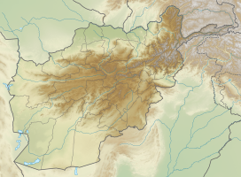
| Coordinates | 34°04′33″N 71°12′14″E / 34.07570°N 71.20394°E |
 | |
The Khyber Pass (Urdu: درۂ خیبر; Pashto: د خيبر دره, romanized: De Xēber Dara, lit. 'Valley of Khyber' [d̪ə xebər d̪ara]) is a mountain pass in the Khyber Pakhtunkhwa province of Pakistan, on the border with the Nangarhar Province of Afghanistan. It connects the town of Landi Kotal to the Valley of Peshawar at Jamrud by traversing part of the White Mountains. Since it was part of the ancient Silk Road, it has been a vital trade route between Central Asia and the Indian subcontinent and a strategic military choke point for various states that controlled it. The Khyber Pass is considered one of the most famous mountain passes in the world.[1]
- ^ Wright, Colin. "Maliks of Khyber Pass". www.bl.uk. Retrieved 2023-03-07.
© MMXXIII Rich X Search. We shall prevail. All rights reserved. Rich X Search


