Back Bikini-ringeiland Afrikaans Bikini-Atoll ALS حلقية بيكيني Arabic اتول بيكينى ARZ Atolón Bikini AST Бікіні (атол) Byelorussian Бикини (атол) Bulgarian Atoll Bikini Breton Atol de Bikini Catalan Bikini Atoll (pulong kagaangan) CEB
Bikini Atoll
Pikinni Atoll, Eschscholtz Atoll | |
|---|---|
 Bikini Atoll. Two craters from Operation Castle can be seen on the northwest cape of the atoll, adjacent to Namu island. The larger is from the 15 Mt Bravo shot, with the smaller 11 Mt Romeo crater adjoining it. | |
| Nickname: Kili | |
| Motto(s): | |
| Anthem: Ij Jab Ber Emol (Marshallese) (English: No longer can I stay) | |
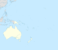
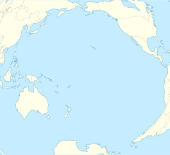
 Map of the Marshall Islands showing Bikini Atoll | |
 Map of Bikini Atoll | |
| Coordinates: 11°36′N 165°24′E / 11.6°N 165.4°E | |
| Country | Republic of the Marshall Islands |
| Area | |
| • Land | 6 km2 (2.3 sq mi) |
| Population | |
| • Total | 5 caretakers[1] |
| Population relocated in 1948 Resettled population evacuated in 1980 | |
| Official name | Bikini Atoll Nuclear Test Site |
| Criteria | Cultural: iv; vi |
| Reference | 1339 |
| Inscription | 2010 (34th Session) |
Bikini Atoll (/ˈbɪkɪˌniː/ or /bɪˈkiːni/; Marshallese: Pikinni, [pʲiɡinnʲi], lit. 'coconut place'),[2] known as Eschscholtz Atoll between the 19th century and 1946,[3] is a coral reef in the Marshall Islands consisting of 23 islands surrounding a 229.4-square-mile (594.1 km2) central lagoon. The Atoll is at the northern end of the Ralik Chain, approximately 530 miles (850 km) northwest of the capital Majuro.
After the Second World War, the atoll was chosen by the United States as a nuclear weapon testing site. All 167 of the atoll's inhabitants were forcibly relocated in 1946[4] to Rongerik, a small island east of Bikini Atoll with inadequate resources to support the population. The islanders began experiencing starvation by early 1948, and they were moved again, this time to Kwajalein Atoll.[5] The United States used the islands and lagoon as the site of 23 nuclear tests until 1958.
In 1970, about 200 residents were returned to their home island by the U.S. government.[6] But scientists found dangerously high levels of strontium-90 in well water in May 1978 and the residents' bodies were carrying abnormally high concentrations of caesium-137. They were evacuated again in 1980. The atoll is occasionally visited today by divers and a few scientists, and is occupied by a handful of caretakers.
- ^ Cite error: The named reference
borrettwas invoked but never defined (see the help page). - ^ "Marshallese-English Dictionary-Place Name Index". Archived from the original on 27 October 2012. Retrieved 8 August 2013.
- ^ "The Marshall Islands: A Brief History". Archived from the original on 15 October 2013. Retrieved 14 August 2013.
- ^ Kiste, Robert C. (1974). The Bikinians : a study in forced migration (PDF). Menlo Park, Calif.: Cummings Pub. Co. ISBN 0846537524. Archived (PDF) from the original on 2 August 2021. Retrieved 2 August 2021.
- ^ Cite error: The named reference
engineeringwas invoked but never defined (see the help page). - ^ Niedenthal, Jack (2001). "A History of the People of Bikini Following Nuclear Weapons Testing in the Marshall Islands". Health Physics. 73 (1): 28–36. doi:10.1097/00004032-199707000-00003. ISSN 0017-9078. PMID 9199216. Archived from the original on 5 July 2023. Retrieved 25 April 2023.
© MMXXIII Rich X Search. We shall prevail. All rights reserved. Rich X Search


