Back Cheyenne Afrikaans Cheyenne (Wyoming) AN Ċieanneburh ANG شايان (وايومنغ) Arabic شايان, وايومنج ARZ Cheyenne (Wyoming) AST Şayenn (Vayominq) Azerbaijani چئین، ویومینق AZB Cheyenne, Wyoming BAR Šajens BAT-SMG
Cheyenne, Wyoming | |
|---|---|
State capital and city | |
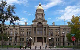
Left to right from top: Downtown Cheyenne, Cheyenne Depot Museum, Union Pacific Big Boy 4004 and the Wyoming State Capitol | |
| Nickname: "Magic City of the Plains" (historic) | |
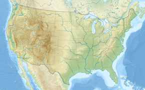
 Location in Laramie County in Wyoming | |
| Coordinates: 41°8′24″N 104°49′13″W / 41.14000°N 104.82028°W | |
| Country | United States |
| State | Wyoming |
| County | Laramie |
| Founded | 1867 |
| Named for | Cheyenne people |
| Government | |
| • Mayor | Patrick Collins[1] |
| Area | |
| • City | 32.37 sq mi (83.84 km2) |
| • Land | 32.26 sq mi (83.55 km2) |
| • Water | 0.11 sq mi (0.29 km2) 0.45% |
| Elevation | 6,086 ft (1,855 m) |
| Population | |
| • City | 65,132 |
| • Density | 1,991.23/sq mi (768.82/km2) |
| Time zone | UTC−7 (Mountain) |
| • Summer (DST) | UTC−6 (Mountain) |
| ZIP Code | 82001–82003, 82006–82010 |
| Area code | 307 |
| FIPS code | 56-13900[5] |
| GNIS feature ID | 1609077[3] |
| Website | cheyennecity.org |
Cheyenne (/ʃaɪˈæn/ shy-AN or /ʃaɪˈɛn/ shy-EN) is the capital and most populous city of the U.S. state of Wyoming, as well as the county seat of Laramie County, with 65,132 residents, per the 2020 census.[6] It is the principal city of the Cheyenne metropolitan statistical area which encompasses all of Laramie County and had 100,512 residents as of the 2020 census. Local residents named the town for the Cheyenne Native American people in 1867 when it was founded in the Dakota Territory. Along with Oklahoma City, Oklahoma and Topeka, Kansas, Cheyenne is one of three state capitals with an indigenous name in a state with an indigenous name.
Cheyenne is the northern terminus of the extensive Southern Rocky Mountain Front, which extends southward to Albuquerque, New Mexico, and includes the fast-growing Front Range Urban Corridor.[4][7] Cheyenne is situated on Crow Creek and Dry Creek.
- ^ Mayor's Office, Cheyenne.
- ^ "2019 U.S. Gazetteer Files". United States Census Bureau. Retrieved August 7, 2020.
- ^ a b "Geographic Names Information System". edits.nationalmap.gov. Retrieved May 8, 2023.
- ^ a b Cite error: The named reference
FactFinderwas invoked but never defined (see the help page). - ^ "American FactFinder". United States Census Bureau. Archived from the original on February 12, 2020. Retrieved January 31, 2008.
- ^ "Find a County". National Association of Counties. Archived from the original on May 3, 2015. Retrieved June 7, 2011.
- ^ "Front Range – America 2050". America2050.org. Archived from the original on July 26, 2017. Retrieved January 9, 2018.
© MMXXIII Rich X Search. We shall prevail. All rights reserved. Rich X Search


