Back كلايتون (ميزوري) Arabic كلايتون (سانت لويس, ميزورى) ARZ کلیتون، میزوری AZB Clayton (Missouri) Catalan Клейтон (Миссури) CE Clayton (kapital sa kondado sa Tinipong Bansa, Missouri) CEB Clayton, Missouri Welsh Clayton (Missouri) German Clayton (Misurio) Esperanto Clayton (Misuri) Spanish
Clayton, Missouri | |
|---|---|
 Clayton high-rises seen from the Moorlands | |
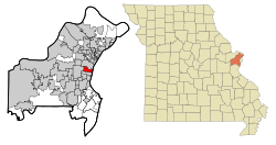
 Location in Missouri | |
 U.S. Census Map | |
| Coordinates: 38°38′40″N 90°19′49″W / 38.64444°N 90.33028°W | |
| Country | United States |
| State | Missouri |
| County | St. Louis |
| Settled | 1877 |
| Incorporated | 1913 |
| Government | |
| • Type | Mayor-council city |
| • Mayor | Michelle Harris |
| Area | |
| • Total | 2.51 sq mi (6.49 km2) |
| • Land | 2.51 sq mi (6.49 km2) |
| • Water | 0.00 sq mi (0.00 km2) |
| Elevation | 551 ft (168 m) |
| Population (2020) | |
| • Total | 17,355 |
| • Density | 6,919.9/sq mi (2,671.8/km2) |
| Time zone | UTC-6 (Central) |
| • Summer (DST) | UTC-5 (Central) |
| ZIP code | 63105 |
| Area code | 314 |
| FIPS code | 29-14572[3] |
| GNIS feature ID | 2393548[2] |
| Website | City of Clayton |
Clayton is a city in and the county seat of St. Louis County, Missouri, and borders the independent city of St. Louis. The population was 17,355 at the 2020 census.[4] Organized in 1877, the city was named after Ralph Clayton, a former slave owner,[5] who donated the land for the St. Louis County courthouse.
- ^ "ArcGIS REST Services Directory". United States Census Bureau. Retrieved August 28, 2022.
- ^ a b U.S. Geological Survey Geographic Names Information System: Clayton, Missouri
- ^ "U.S. Census website". United States Census Bureau. Retrieved January 31, 2008.
- ^ "2020 Census Results". Census.gov. Retrieved October 2, 2022.
- ^ Eaton, David Wolfe (1918). How Missouri Counties, Towns and Streams Were Named. The State Historical Society of Missouri. p. 359.
© MMXXIII Rich X Search. We shall prevail. All rights reserved. Rich X Search