Back مقاطعة كورييل (تكساس) Arabic کوریل بؤلگهسی، تکزاس AZB Coryell County, Texas BAR Кор’ел (акруга) Byelorussian Кориел (окръг, Тексас) Bulgarian কোরয়েল কাউন্টি, টেক্সাস BPY Coryell Gông (Texas) CDO Coryell County CEB Coryell County Czech Coryell County, Texas Welsh
Coryell County | |
|---|---|
 The Coryell County Courthouse in Gatesville, Texas. The courthouse was added to the National Register of Historic Places on August 18, 1977. | |
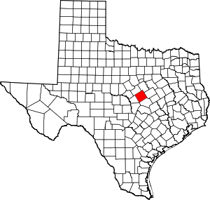
 Location within the U.S. state of Texas | |
 Texas's location within the U.S. | |
| Coordinates: 31°23′N 97°48′W / 31.39°N 97.8°W | |
| Country | |
| State | |
| Founded | 1854 |
| Seat | Gatesville |
| Largest city | Copperas Cove |
| Area | |
| • Total | 1,057 sq mi (2,740 km2) |
| • Land | 1,052 sq mi (2,720 km2) |
| • Water | 4.7 sq mi (12 km2) 0.4% |
| Population (2020) | |
| • Total | 83,093 |
| • Density | 79/sq mi (30/km2) |
| Time zone | UTC−6 (Central) |
| • Summer (DST) | UTC−5 (CDT) |
| Congressional district | 31st |
| Website | www |
Coryell County (/ˈkɔːrjɛl/ KOR-yel)[1] is a county located on the Edwards Plateau in the U.S. state of Texas. As of the 2020 census, its population was 83,093.[2][3] The county seat is Gatesville.[4] The county is named for James Coryell, a frontiersman and Texas Ranger who was killed by Caddo Indians.
Coryell County is part of the Killeen–Temple metropolitan statistical area.
- ^ "Archived copy". Archived from the original on August 18, 2014. Retrieved November 28, 2012.
{{cite web}}: CS1 maint: archived copy as title (link) - ^ "U.S. Census Bureau QuickFacts: Coryell County, Texas". United States Census Bureau. Retrieved January 31, 2022.
- ^ "Coryell County, Texas". United States Census Bureau. Retrieved February 23, 2021.
- ^ "Find a County". National Association of Counties. Archived from the original on May 9, 2015. Retrieved June 7, 2011.
© MMXXIII Rich X Search. We shall prevail. All rights reserved. Rich X Search