Back سنت جينيفيف Arabic سنت جينيفيف ARZ سینت جنویو، میزوری AZB Sainte Genevieve (Missouri) Catalan Сант-Женевиев (Миссури) CE Sainte Genevieve CEB Ste. Genevieve, Missouri Welsh Sainte Genevieve DAG Ste. Genevieve (Missouri) German Ste. Genevieve (Misuri) Spanish
Ste. Genevieve, Missouri | |
|---|---|
City | |
 Maison Bequette-Ribault, c. 1805, privately owned | |
| Nickname: "The Mother City of the West"[1] | |
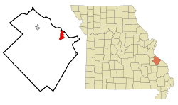
 Location of Ste. Genevieve, Missouri | |
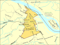
 U.S. Census Map | |
| Coordinates: 37°58′32″N 90°02′52″W / 37.97556°N 90.04778°W | |
| Country | United States |
| State | Missouri |
| County | Ste. Genevieve |
| Township | Ste. Genevieve |
| Incorporated | 1805 |
| Named for | Saint Genevieve |
| Government | |
| • Mayor | Brian Keim |
| Area | |
| • Total | 3.90 sq mi (10.11 km2) |
| • Land | 3.90 sq mi (10.10 km2) |
| • Water | 0.00 sq mi (0.01 km2) |
| Elevation | 427 ft (130 m) |
| Population (2020) | |
| • Total | 4,999 |
| • Density | 1,282.12/sq mi (495.00/km2) |
| Time zone | UTC-6 (Central (CST)) |
| • Summer (DST) | UTC-5 (CDT) |
| Zip code | 63670 |
| Area code | 573 |
| FIPS code | 29-64180[4] |
| GNIS feature ID | 2396523[3] |
| Website | http://www.stegenevieve.org/ |
Ste. Genevieve (French: Sainte-Geneviève [sɛ̃t ʒən.vjɛv]) is a city in Ste. Genevieve Township and is the county seat of Ste. Genevieve County, Missouri, United States.[5] The population was 4,999 at the 2020 census.[6] Founded in 1735 by French Canadian colonists and settlers from east of the river, it was the first organized European settlement west of the Mississippi River in present-day Missouri. Today, it is home to Ste. Genevieve National Historical Park, the 422nd unit of the National Park Service.
- ^ "The Ste. Genevieve Herald tagline "Printed in the Mother City of the West since 1882"". Retrieved September 10, 2014.
- ^ "ArcGIS REST Services Directory". United States Census Bureau. Retrieved August 28, 2022.
- ^ a b U.S. Geological Survey Geographic Names Information System: Ste. Genevieve, Missouri
- ^ "U.S. Census website". United States Census Bureau. Retrieved January 31, 2008.
- ^ "Find a County". National Association of Counties. Retrieved June 7, 2011.
- ^ "Explore Census Data".
© MMXXIII Rich X Search. We shall prevail. All rights reserved. Rich X Search