Back Hālgabærbera Sċīr ANG مقاطعة سانتا باربارا (كاليفورنيا) Arabic مقاطعة سانتا باربارا (كاليفورنيا) ARZ Santa-Barbara qraflığı (Kaliforniya) Azerbaijani Santa Barbara County, Kalifornien BAR Санта-Барбара (акруга) Byelorussian Санта Барбара (окръг) Bulgarian সান্তা বারবারা কাউন্টি, ক্যালিফোর্নিয়া BPY Comtat de Santa Barbara Catalan Санта-Барбара (гуо, Калифорни) CE
Santa Barbara County | |
|---|---|
| County of Santa Barbara | |
|
Images, from top down, left to right: The Santa Barbara County Courthouse; Lake Cachuma; Vandenberg Space Force Base's main gate; along Foxen Canyon Road, running between the Santa Maria and Santa Ynez Valleys; Danish-styled Solvang | |
 Interactive map of Santa Barbara County | |
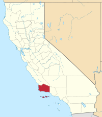
 Location in the state of California | |
| Country | United States |
| State | California |
| Region | California Central Coast |
| Incorporated | February 18, 1850[1] |
| Named for | The city of Santa Barbara, which was named for Saint Barbara |
| County seat | Santa Barbara |
| Largest city | Santa Maria (population) Santa Barbara (area) |
| Government | |
| • Type | Council–CEO |
| • Body | Board of Supervisors [2][3][4][5][6] |
| • Chair [7] | Steve Lavagnino (N.P.) |
| • Vice Chair [8] | Laura Capps (N.P.) |
| • Board of Supervisors[9] | |
| • County executive officer[10] | Mona Miyasato |
| Area | |
| • Total | 3,789 sq mi (9,810 km2) |
| • Land | 2,735 sq mi (7,080 km2) |
| • Water | 1,054 sq mi (2,730 km2) |
| Highest elevation | 6,803 ft (2,074 m) |
| Population (2020) | |
| • Total | 448,229 |
| • Density | 163/sq mi (63/km2) |
| Time zone | UTC−8 (Pacific Time Zone) |
| • Summer (DST) | UTC−7 (Pacific Daylight Time) |
| Area code(s) | 805, 820 |
| GDP | $26.135 billion (2017)[12] |
| GDP per capita | $51,285 (2017) [13] |
| Congressional district | 24th |
| Website | CountyofSB.org |
Santa Barbara County, officially the County of Santa Barbara (Spanish: Condado de Santa Bárbara), is located in Southern California. As of the 2020 census, the population was 448,229.[14] The county seat is Santa Barbara,[15] and the largest city is Santa Maria.
Santa Barbara County comprises the Santa Maria-Santa Barbara, CA Metropolitan Statistical Area. Most of the county is part of the California Central Coast.[16] Mainstays of the county's economy include engineering, resource extraction (particularly petroleum extraction and diatomaceous earth mining), winemaking, agriculture, and education. The software development and tourism industries are important employers in the southern part of the county.
Southern Santa Barbara County is sometimes considered the cultural boundary of Southern California/Northern California.[17]
- ^ "Chronology". California State Association of Counties. Retrieved February 6, 2015.
- ^ "Das Williams, Supervisor, District 1 from Santa Barbara County, California".
- ^ "Gregg Hart, Supervisor, District 2 from Santa Barbara County, California".
- ^ "Joan Hartmann, Supervisor, District 3 from Santa Barbara County, California".
- ^ "Bob Nelson, Supervisor, District 4 from Santa Barbara County, California".
- ^ "Steve Lavagnino, Supervisor, District 5 from Santa Barbara County, California".
- ^ "Fifth District | Santa Barbara County, CA - Official Website".
- ^ "Second District | Santa Barbara County, CA - Official Website".
- ^ "Board of Supervisors | Santa Barbara County, CA - Official Website".
- ^ "Executive and Administrative Team | Santa Barbara County, CA - Official Website".
- ^ "Big Pine Mountain". Peakbagger.com. Retrieved March 15, 2015.
- ^ Total Gross Domestic Product for Santa Maria-Santa Barbara Federal Reserve Economic Data. Retrieved June 16, 2019
- ^ Total Per Capita Real Gross Domestic Product for Santa Maria-Santa Barbara Federal Reserve Economic Data. Retrieved June 16, 2019
- ^ "Santa Barbara County, California". United States Census Bureau. Retrieved January 30, 2022.
- ^ "Find a County". National Association of Counties. Retrieved June 7, 2011.
- ^ "Central Coast". California State Parks. California Department of Recreation. Retrieved July 26, 2014.
- ^ Leilah Bernstein, "Then and Now" - Los Angeles Times, December 31, 1999, page 1
© MMXXIII Rich X Search. We shall prevail. All rights reserved. Rich X Search


