Back El Hierro Afrikaans El Hierro AN إل هييرو Arabic El Hierro AST İerro Azerbaijani Эль-Ера Byelorussian Йеро Bulgarian El Hierro Breton El Hierro Catalan El Hierro (pulo) CEB
You can help expand this article with text translated from the corresponding article in German. (November 2015) Click [show] for important translation instructions.
|
Nickname: Isla del Meridiano | |
|---|---|
 | |
 | |
| Geography | |
| Location | Atlantic Ocean |
| Coordinates | 27°45′N 18°00′W / 27.750°N 18.000°W |
| Archipelago | Canary Islands |
| Area | 268.51 km2 (103.67 sq mi)[1] |
| Highest elevation | 1,501 m (4925 ft) |
| Highest point | Pico de Malpaso |
| Administration | |
Spain | |
| Autonomous Community | Canary Islands |
| Province | Santa Cruz de Tenerife |
| Capital city | Valverde |
| Demographics | |
| Population | 11,659 (start of 2023) |
| Pop. density | 43.4/km2 (112.4/sq mi) |
| Languages | Spanish, specifically Canarian Spanish |
| Additional information | |
| Time zone | |
| • Summer (DST) | |

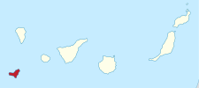
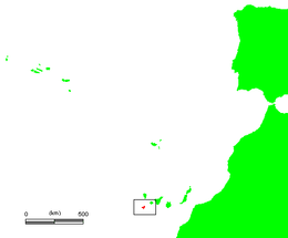
El Hierro, nicknamed Isla del Meridiano (the "Meridian Island"), is the second-smallest and farthest south and west of the Canary Islands (an autonomous community of Spain), in the Atlantic Ocean off the coast of Africa, with a population of 11,659 (2023).[2][3] Its capital is Valverde. At 268.51 square kilometres (103.67 sq mi), it is the second-smallest of the eight main islands of the Canaries.
- ^ "Islas e islotes con superficie superior a 1 Km2". Instituto Geográfico Nacional. Archived from the original on 2015-07-22.
- ^ Instituto Nacional de Estadistica, Madrid, 2023.
- ^ "Population referred to the January 1, 2018". Archived from the original on 3 March 2016. Retrieved 5 August 2019.
© MMXXIII Rich X Search. We shall prevail. All rights reserved. Rich X Search