Back خورتيتسيا Arabic Xortisa Azerbaijani Хорціца Byelorussian Хортыца BE-X-OLD Хортица Bulgarian Хортица CE Ostriv Khortytsya CEB Chortycja Czech Chortyzja German Ĥorticja Esperanto
This article includes a list of general references, but it lacks sufficient corresponding inline citations. (June 2014) |
Native name: Хортиця | |
|---|---|
| Geography | |
| Location | Dnieper River |
| Coordinates | 47°49′12″N 35°06′00″E / 47.82000°N 35.10000°E |
| Area | 23.59 km2 (9.11 sq mi) |
| Length | 12.5 km (7.77 mi) |
| Width | 2.5 km (1.55 mi) |
| Highest elevation | 30 m (100 ft) |
| Highest point | N/A |
| Administration | |
Ukraine | |
| Oblast | Zaporizhzhia Oblast |
| City | Zaporizhzhia |
| District | Voznesenivskyi District |
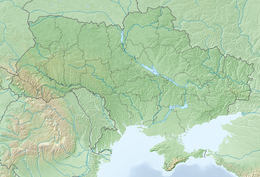
Khortytsia (Ukrainian: Хортиця, pronounced [ˈxɔrtɪtsʲɐ]) is the largest island on the Dnieper River, and is 12.5 km (7.77 mi) long and up to 2.5 km (1.55 mi) wide.[1] The island forms part of the Khortytsia National Reserve.[1] This historic site is located within the city limits of Zaporizhzhia,[2] Ukraine.
The island has played an important role in the history of Ukraine, especially in the history of the Zaporozhian Cossacks. The island has unique flora and fauna, including oak groves, spruce woods, meadows, and steppe. The northern part of the island is very rocky and high (rising 30 m or 98 ft above the river bed) in comparison to the southern part, which is low, and often flooded by the waters of the Dnieper.
- ^ a b ЗАПОРІЗЬКИЙ ОБЛАСНИЙ ТУРИСТИЧНО-ІНФОРМАЦІЙНИЙ ЦЕНТР (in Ukrainian). Zaporizhzhia Regional Tourist Information Centre, National Park Khortytsia. Archived from the original on 26 January 2018. Retrieved 3 April 2019.
- ^ ЗАПОРІЗЬКИЙ ОБЛАСНИЙ ТУРИСТИЧНО-ІНФОРМАЦІЙНИЙ ЦЕНТР (in Ukrainian). Zaporizhzhia Regional Tourist Information Centre, Zaporizhzhia. Archived from the original on 16 February 2018. Retrieved 3 April 2019.
© MMXXIII Rich X Search. We shall prevail. All rights reserved. Rich X Search

