Back بيرتيفيل (كيبك) Arabic Berthierville ATJ Berthierville (lungsod) CEB Berthierville, Quebec DIQ Berthierville Spanish Berthierville Estonian Berthierville (Quebec) Basque برتیهویل، کبک Persian Berthierville French Berthierville, Québec HAK
Berthierville | |
|---|---|
 | |
 Location within D'Autray RCM | |
| Coordinates: 46°05′N 73°11′W / 46.083°N 73.183°W[1] | |
| Country | Canada |
| Province | Quebec |
| Region | Lanaudière |
| RCM | D'Autray |
| Constituted | April 14, 1852 |
| Government | |
| • Mayor | Pierre Lahaie |
| • Federal riding | Berthier—Maskinongé |
| • Prov. riding | Berthier |
| Area | |
| • Total | 7.20 km2 (2.78 sq mi) |
| • Land | 6.85 km2 (2.64 sq mi) |
| Population (2011)[3] | |
| • Total | 4,091 |
| • Density | 596.8/km2 (1,546/sq mi) |
| • Pop 2006-2011 | |
| • Dwellings | 2,007 |
| Time zone | UTC−5 (EST) |
| • Summer (DST) | UTC−4 (EDT) |
| Postal code(s) | |
| Area codes | 450 and 579 |
| Highways | |
| Website | www |
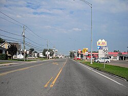
Berthierville (/ˈbɛərtjeɪvɪl/)[4](also called Berthier-en-haut, and legally called Berthier before 1942) is a town located between Montreal and Trois-Rivières on the north shore of the Saint Lawrence River in Quebec, Canada. Berthierville is the seat of D'Autray Regional County Municipality, and is served by Autoroute 40, and is the junction of Routes 138 and 158. It is surrounded by the parish municipality of Sainte-Geneviève-de-Berthier.
The Marie Reine du Canada Pilgrimage column stops at the church of Sainte-Geneviève de Berthierville for Mass on the first day of its three-day walk from Lanoraie to Cap-de-la-Madeleine.

- ^ Cite error: The named reference
toponymiewas invoked but never defined (see the help page). - ^ a b Cite error: The named reference
mamrotwas invoked but never defined (see the help page). - ^ a b Statistics Canada 2011 Census - Berthierville census profile
- ^ The Canadian Press (2017), The Canadian Press Stylebook (18th ed.), Toronto: The Canadian Press
© MMXXIII Rich X Search. We shall prevail. All rights reserved. Rich X Search

