Back Mauna Kea Afrikaans ማውና ኬያ Amharic مونا كيا Arabic جبل مونا كيا ARZ Mauna Kea AST Mauna Kea Azerbaijani Mauna Kéa BAN Mauna Kea BCL Мауна-Кеа Byelorussian Мауна Кеа Bulgarian
| Mauna Kea | |
|---|---|
| Maunakea[1] | |
 Mauna Kea in December 2007, with its seasonal snow cap visible | |
| Highest point | |
| Elevation | 4,207.3 m (13,803 ft)[2] |
| Prominence | 9,330 m (30,610 ft)[2] |
| Isolation | 3,947 km (2,453 mi)[3] |
| Listing | |
| Coordinates | 19°49′14.4″N 155°28′05.0″W / 19.820667°N 155.468056°W[2] |
| Geography | |
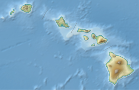
| Location | Hawaiʻi County, Hawaiʻi, United States |
| Parent range | Hawaiian Islands |
| Geology | |
| Age of rock | Oldest dated rock: 237,000 ± 31,000 years BP[4] Approximate: ~1 million years[4] |
| Mountain type | Shield volcano Hotspot volcano |
| Volcanic arc/belt | Hawaiian–Emperor seamount chain |
| Last eruption | 2460 BCE ± 100 years |
| Climbing | |
| First ascent | Recorded: Goodrich (1823)[5] |
| Easiest route | Mauna Kea Trail |
| Designated | November 1972 |
Mauna Kea (/ˌmɔːnə ˈkeɪə/ or /ˌmaʊnə ˈkeɪə/;[6] Hawaiian: [ˈmɐwnə ˈkɛə]; abbreviation for Mauna a Wākea)[7] is an inactive shield volcano on the island of Hawaiʻi.[8] Its peak is 4,207.3 m (13,803 ft) above sea level, making it the highest point in Hawaii and second-highest peak of an island on Earth. The peak is about 38 m (125 ft) higher than Mauna Loa, its more massive neighbor. Mauna Kea is unusually topographically prominent for its height: its wet prominence is fifteenth in the world among mountains, at 4,205 m (13,796 ft); its dry prominence is 9,330 m (30,610 ft). This dry prominence is greater than Mount Everest's height above sea level of 8,848.86 m (29,032 ft), and some authorities have labeled Mauna Kea the tallest mountain in the world, from its underwater base.[a] Mauna Kea is ranked 8th by topographic isolation.
It is about one million years old and thus passed the most active shield stage of life hundreds of thousands of years ago. In its current post-shield state, its lava is more viscous, resulting in a steeper profile. Late volcanism has also given it a much rougher appearance than its neighboring volcanoes due to construction of cinder cones, decentralization of its rift zones, glaciation on its peak, and weathering by the prevailing trade winds. Mauna Kea last erupted 6,000 to 4,000 years ago and is now thought to be dormant.
In Hawaiian religion, the peaks of the island of Hawaiʻi are sacred. An ancient law allowed only high-ranking aliʻi to visit its peak. Ancient Hawaiians living on the slopes of Mauna Kea relied on its extensive forests for food, and quarried the dense volcano-glacial basalts on its flanks for tool production. When Europeans arrived in the late 18th century, settlers introduced cattle, sheep, and game animals, many of which became feral and began to damage the volcano's ecological balance. Mauna Kea can be ecologically divided into three sections: an alpine climate at its summit, a Sophora chrysophylla–Myoporum sandwicense (or māmane–naio) forest on its flanks, and an Acacia koa–Metrosideros polymorpha (or koa–ʻōhiʻa) forest, now mostly cleared by the former sugar industry, at its base. In recent years, concern over the vulnerability of the native species has led to court cases that have forced the Hawaiʻi Department of Land and Natural Resources to work towards eradicating all feral species on the volcano.
With its high elevation, dry environment, and stable airflow, Mauna Kea's summit is one of the best sites in the world for astronomical observation. Since the creation of an access road in 1964, thirteen telescopes funded by eleven countries have been constructed at the summit. The Mauna Kea Observatories are used for scientific research across the electromagnetic spectrum and comprise the largest such facility in the world. Their construction on a landscape considered sacred by Native Hawaiians continues to be a topic of debate to this day.
- ^ "Why does OMKM spell "Maunakea" as one word?". Office of Maunakea Management. Archived from the original on September 3, 2018. Retrieved February 26, 2019.
- ^ a b c "Mauna Kea". NGS Station Datasheet. United States National Geodetic Survey. Archived from the original on February 2, 2016. Retrieved October 27, 2015.
- ^ "Mauna Kea". Summits of the World. peakbagger.com. Archived from the original on October 23, 2015. Retrieved October 27, 2015.
- ^ a b "Mauna Kea Hawai'i's Tallest Volcano". Hawaiian Volcano Observatory – United States Geological Survey. May 22, 2002. Archived from the original on September 4, 2010. Retrieved August 8, 2010.
- ^ Cite error: The named reference
esa-1940was invoked but never defined (see the help page). - ^ Wells, John C. (2008). Longman Pronunciation Dictionary (3rd ed.). Longman. ISBN 978-1-4058-8118-0.
- ^ Hit, Christine (August 5, 2019). "The Sacred History of Maunakea". Honolulu Magazine. Archived from the original on September 24, 2020. Retrieved July 28, 2021.; Fujikane, Candace (September 1, 2019). "Mapping Abundance on Mauna a Wākea as a Practice of Ea". Hūlili: Multidisciplinary Research on Hawaiian Well-Being. Vol. 11, no. 1. pp. 23–54.
- ^ "Active Volcanoes of Hawaii | U.S. Geological Survey". www.usgs.gov. Retrieved May 1, 2023.
- ^ Cite error: The named reference
Mauna Keawas invoked but never defined (see the help page). - ^ Cite error: The named reference
Guinnesswas invoked but never defined (see the help page). - ^ Cite error: The named reference
How High is Mauna Loawas invoked but never defined (see the help page).
Cite error: There are <ref group=lower-alpha> tags or {{efn}} templates on this page, but the references will not show without a {{reflist|group=lower-alpha}} template or {{notelist}} template (see the help page).
© MMXXIII Rich X Search. We shall prevail. All rights reserved. Rich X Search

