Back جبل كيلي Arabic جبل كيلى ARZ Mount Cayley CEB Mount Cayley German کوه کیلی Persian Mont Cayley French Mont Cayley Occitan Monte Cayley Portuguese Mount Cayley SIMPLE Mount Cayley Swedish
| Mount Cayley | |
|---|---|
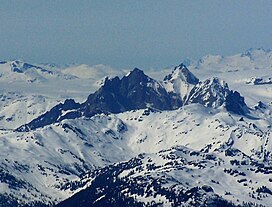
 Mount Cayley as seen from the southeast. Summits left to right are Pyroclastic Peak, Mount Cayley and Wizard Peak. | |
| Highest point | |
| Elevation | 2,385 m (7,825 ft)[1] |
| Prominence | 674 m (2,211 ft)[1] |
| Parent peak | Mount Callaghan (2409 m)[1] |
| Listing | Mountains of British Columbia |
| Coordinates | 50°07′13″N 123°17′27″W / 50.12028°N 123.29083°W |
| Geography | |
| Country | Canada |
| Province | British Columbia |
| District | New Westminster Land District |
| Range coordinates | 50°06′58″N 123°17′15″W / 50.11611°N 123.28750°W |
| Parent range | Pacific Ranges |
| Topo map | NTS 92J3 Brandywine Falls |
| Geology | |
| Formed by | Stratovolcano, lava domes |
| Age of rock | Neogene-to-Quaternary |
| Volcanic arc/belt | Canadian Cascade Arc Garibaldi Volcanic Belt |
| Climbing | |
| First ascent | 1928 by E. C. Brooks, W. G. Wheatley, B. Clegg, R. E. Knight and T. Fyles |
Mount Cayley is an eroded but potentially active stratovolcano in the Pacific Ranges of southwestern British Columbia, Canada. Located 45 km (28 mi) north of Squamish and 24 km (15 mi) west of Whistler, the volcano resides on the edge of the Powder Mountain Icefield. It consists of massif that towers over the Cheakamus and Squamish river valleys. All major summits have elevations greater than 2,000 m (6,600 ft), Mount Cayley being the highest at 2,385 m (7,825 ft). The surrounding area has been inhabited by indigenous peoples for more than 7,000 years while geothermal exploration has taken place there for the last four decades.
Part of the Garibaldi Volcanic Belt, Mount Cayley was formed by subduction zone volcanism along the western margin of North America. Eruptive activity began about 4,000,000 years ago and has since undergone three stages of growth, the first two of which built most of the volcano. The latest eruptive period occurred sometime in the last 400,000 years with lesser activity continuing into the present day.
Future eruptions are likely to threaten neighbouring communities with pyroclastic flows, lahars (volcanically induced mudslides, landslides and debris flows) and floods. To monitor this threat, the volcano and its surroundings are monitored by the Geological Survey of Canada (GSC). Eruption impact would be largely a result of the concentration of vulnerable infrastructure in nearby valleys.
- ^ a b c d "Mount Cayley". Bivouac.com. Retrieved 2021-04-09.
- ^ "Mount Cayley". Peakbagger.com. Retrieved 2021-04-09.
© MMXXIII Rich X Search. We shall prevail. All rights reserved. Rich X Search
