Back إقليم الجبال Arabic Горныя штаты Byelorussian Horské státy Czech Mountain States German Estados montañosos Spanish États des montagnes French מדינות הרי הרוקי HE Լեռնային նահանգներ Armenian Stati delle Montagne Rocciose Italian アメリカ合衆国山岳部 Japanese


The Mountain states (also known as the Mountain West or the Interior West) form one of the nine geographic divisions of the United States that are officially recognized by the United States Census Bureau. It is a subregion of the Western United States.
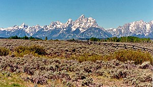
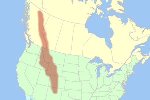
The Mountain states are considered to include: Arizona, Colorado, Idaho, Montana, Nevada, New Mexico, Utah and Wyoming. The words "Mountain states" generally refer to the U.S. States which encompass the U.S. Rocky Mountains. These are oriented north-south through portions of the states of Montana, Idaho, Wyoming, Colorado, Utah, and New Mexico. Arizona and Nevada, as well as other parts of Utah and New Mexico, have other smaller mountain ranges and scattered mountains located in them as well. Sometimes, the Trans-Pecos area of West Texas is considered part of the region. The land area of the eight states together is some 855,767 square miles (2,216,426 km2).
It is the fastest-growing region in the United States, with Utah, Idaho, Nevada, Colorado, and Arizona ranking among the fastest-growing states in the country.[1]
A few subregions exist within this region:
- The Southwest region, consisting of Arizona, New Mexico, Southern Nevada, and Far West Texas[2]
- The Intermountain region, consisting of Utah, Nevada, and Idaho, along with portions of other states[3]
- The Front Range region, consisting of Northern New Mexico, Colorado, and Southeast Wyoming[4]
- ^ "Change in Resident Population of the 50 States, the District of Columbia, and Puerto Rico: 1910 to 2020" (PDF).
- ^ "The Southwest Defined". jsw.library.arizona.edu. Retrieved March 21, 2020.
- ^ Blake, Reed H. (2002). The Intermountain West: a story of a place and people. Boston, MA: Pearson Custon Pub. ISBN 0-536-66915-5. OCLC 51680869.
- ^ "Front Range - America 2050". www.america2050.org. Retrieved March 21, 2020.
© MMXXIII Rich X Search. We shall prevail. All rights reserved. Rich X Search