Back بالي (البوسنة والهرسك) Arabic Pale (Bosniya və Herseqovina) Azerbaijani Пале (горад) BE-X-OLD Пале (Босна и Херцеговина) Bulgarian Pale (Republika Srpska) BS Pale (Bòsnia i Hercegovina) Catalan Pale (lungsod sa Bosniya ug Ersogobina, Republika Srpska) CEB Pale Czech Pale Danish Pale (Bosnien und Herzegowina) German
This article needs additional citations for verification. (March 2016) |
Pale
Пале | |
|---|---|
Town and municipality | |
|
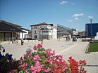
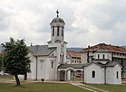
Views of Pale | |
 Location of Pale, Bosnia and Herzegovina within Bosnia and Herzegovina | |
 | |
| Coordinates: 43°48′43″N 18°34′16″E / 43.81194°N 18.57111°E | |
| Country | |
| Entity | |
| City | |
| Government | |
| • Municipal mayor | Boško Jugović (SNSD) |
| • Municipality | 492.8 km2 (190.3 sq mi) |
| Population (2013 census) | |
| • Town | 13,883 |
| • Municipality | 22,282 |
| • Municipality density | 45/km2 (120/sq mi) |
| Time zone | UTC+1 (CET) |
| • Summer (DST) | UTC+2 (CEST) |
| Area code | 57 |
Pale (Serbian Cyrillic: Пале) is a municipality of the city of Istočno Sarajevo, Republika Srpska, Bosnia and Herzegovina. It is situated southeast of the capital city of Sarajevo. As of 2013, it had a population of 22,282 inhabitants, while the town of Pale has a population of 13,883 inhabitants.
The famous Jahorina ski resort is located some 15 km (9.3 mi) from the municipality.
© MMXXIII Rich X Search. We shall prevail. All rights reserved. Rich X Search


