Back Ted Stevens Anchorage Internasionale Lughawe Afrikaans مطار تيد ستيفنز أنكوراج الدولي Arabic مطار تيد ستيفنز انكوراج الدولى ARZ Aeropuertu Internacional Ted Stevens Anchorage AST Anchorage International Airport CEB Letiště Anchorage Czech Ted Stevens Anchorage International Airport Danish Ted Stevens Anchorage International Airport German Διεθνές Αεροδρόμιο του Άνκορεϊτζ «Τεντ Στίβενς» Greek Aeropuerto Internacional Ted Stevens Anchorage Spanish
Ted Stevens Anchorage International Airport | |||||||||||||||||||
|---|---|---|---|---|---|---|---|---|---|---|---|---|---|---|---|---|---|---|---|
 | |||||||||||||||||||
 | |||||||||||||||||||
| Summary | |||||||||||||||||||
| Airport type | Public | ||||||||||||||||||
| Owner/Operator | State of Alaska DOT&PF | ||||||||||||||||||
| Serves | Anchorage metropolitan area | ||||||||||||||||||
| Opened | 1951 | ||||||||||||||||||
| Hub for | |||||||||||||||||||
| Elevation AMSL | 151 ft / 46 m | ||||||||||||||||||
| Coordinates | 61°10′27″N 149°59′54″W / 61.17417°N 149.99833°W | ||||||||||||||||||
| Website | ancairport | ||||||||||||||||||
| Maps | |||||||||||||||||||
 FAA airport diagram | |||||||||||||||||||
 | |||||||||||||||||||
| Runways | |||||||||||||||||||
| |||||||||||||||||||
| Helipads | |||||||||||||||||||
| |||||||||||||||||||
| Statistics (2023) | |||||||||||||||||||
| |||||||||||||||||||
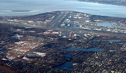
Ted Stevens Anchorage International Airport (IATA: ANC, ICAO: PANC, FAA LID: ANC)[3] is a major airport in the U.S. state of Alaska, located 5 miles (8 km) southwest of downtown Anchorage.[1] The airport is named for Ted Stevens, who served as a senator of Alaska from 1968 to 2009. It is included in the Federal Aviation Administration (FAA) National Plan of Integrated Airport Systems for 2017–2021, in which it is categorized as a medium-hub primary commercial service facility.[4]
- ^ a b FAA Airport Form 5010 for ANC PDF. Federal Aviation Administration. effective December 30, 2021.
- ^ Cite error: The named reference
transtats.bts.govwas invoked but never defined (see the help page). - ^ "ANC - Anchorage [Ted Stevens Anchorage Intl], AK, US - Airport - Great Circle Mapper". Archived from the original on September 19, 2015. Retrieved June 4, 2015.
- ^ "List of NPIAS Airports" (PDF). FAA.gov. Federal Aviation Administration. October 21, 2016. Archived (PDF) from the original on May 3, 2017. Retrieved May 6, 2017.
© MMXXIII Rich X Search. We shall prevail. All rights reserved. Rich X Search