Back تيتوفو Arabic تيتوفو ARZ Цетава Byelorussian Тэтава BE-X-OLD Тетово Bulgarian তেতোভো Bengali/Bangla Tetovo Breton Tetovo (kapital sa munisipyo) CEB Tetovo Czech Хътѣтово CU
Tetovo
| |
|---|---|
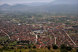
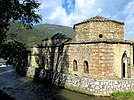
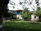
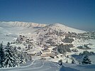
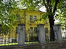
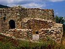
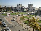
From top: View over Tetovo, Isa Beg Hammam, Arabati Baba Teḱe, Painted Mosque, Church of St Cyril and Methodius, Popova Šapka, Urban Tetovo, Baltepe Fortress, Tetovo centre. | |
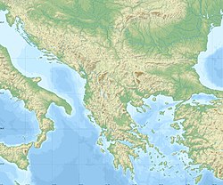
 Location in Northwestern North Macedonia. | |
| Coordinates: 42°00′N 20°58′E / 42.000°N 20.967°E | |
| Country | |
| Region | |
| Municipality | |
| Government | |
| • Mayor | Bilal Kasami (Besa Movement) |
| Area | |
| • Total | 1,068 km2 (412 sq mi) |
| Elevation | 468 m (1,535 ft) |
| Population (2021)[citation needed] | |
| • Total | 63,176 |
| Demonym(s) | (Macedonian: Тетовчанец/Тетовчанка) (Albanian: Tetovar/Tetovare) |
| Time zone | UTC+1 (CET) |
| • Summer (DST) | UTC+2 (CEST) |
| Postal code | 1200 |
| Area code | +389 044 |
| Car plates | TE |
| Climate | Cfb |
| Website | tetovo.gov.mk . |
Tetovo (Macedonian: Тетово, [ˈtɛtɔvɔ] ⓘ; Albanian: Tetovë/Tetova) is a city in the northwestern part of North Macedonia, built on the foothills of Šar Mountain and divided by the Pena River. The municipality of Tetovo covers an area of 1,080 km2 (417 sq mi) at 468 meters (1,535 ft) above sea level, with a population of 63,176.[1] The city of Tetovo is the seat of Tetovo Municipality.
Tetovo was founded in the 14th century on the place of the ancient town of Oaeneon.[2]
In the 15th c. AD, Tetovo came under Ottoman rule for about five centuries. After its conquest by the Ottomans, most of city's population converted to Islam and many Ottoman-style structures were built, such as the Šarena Džamija and the Arabati Baba Teḱe, which still stand as two of North Macedonia's most significant landmarks of its Ottoman period. During this period, the town belonged to the Vilayet of Kosovo, became a firearm and cannon foundry, and was renamed Kalkandelen (meaning Shield Penetrator); as a result, the town attracted many workers and grew to a city. Following the World Wars, Tetovo became a part of Yugoslavia and, later, the Republic of Macedonia.[3]
South East European University, North Macedonia's third largest university after Skopje and Bitola, is located in Tetovo.[4] Tetovo is also home to the State University of Tetovo.
- ^ "2002 Census results" (PDF).
- ^ Thammy Evans, Philip Briggs, Bradt Travel Guides, 2019, North Macedonia, ISBN 1784770841, p. 164.
- ^ Trankova, Dimana (2011). "Tito, Teto and Some Troubled Tourism Await You in Tetovo, Macedonia". Balkan Traveller. Archived from the original on 2 October 2011.
- ^ Evans, Thammy (2012). Macedonia. Bradt Travel Guides Ltd, IDC House, The Vale, Chalfront St Peter, Bucks SL9 9RZ, England: The Globe Pequot Press Inc. pp. 238–239. ISBN 978-1-84162-395-5.
{{cite book}}: CS1 maint: location (link)
© MMXXIII Rich X Search. We shall prevail. All rights reserved. Rich X Search
