Back Tsumeb Afrikaans تسوميب Arabic Цумеб Byelorussian Цумеб Bulgarian Tsumeb Catalan Tsumeb (lungsod) CEB Tsumeb Danish Tsumeb German Τσουμέμπ Greek Cumebo Esperanto
Tsumeb
| |
|---|---|
City | |
 | |
| Motto(s): Glück Auf (German for Good luck) | |
| Coordinates: 19°15′S 17°52′E / 19.250°S 17.867°E | |
| Country | |
| Region | Oshikoto Region |
| Constituency | Tsumeb Constituency |
| Area | |
| • Total | 195 sq mi (504 km2) |
| Elevation | 4,098 ft (1,249 m) |
| Population | |
| • Total | 34,960 |
| • Density | 180/sq mi (69/km2) |
| Time zone | UTC+2 (SAST) |
| Climate | BSh |
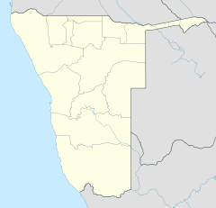
Tsumeb (Otjiherero: Okavisume;[3] Khoekhoe: ǂAixorobes) is a city[4] of around 35,000 inhabitants and the largest town in the Oshikoto region in northern Namibia. Tsumeb is known as the "gateway to the north" of Namibia.[5] It is the closest town to the Etosha National Park. Tsumeb used to be the regional capital of Oshikoto until 2008 when Omuthiya was proclaimed a town and the new capital.[6] The area around Tsumeb forms its own electoral constituency and has a population of 44,113.[7] The town is the site of a deep mine (the lower workings now closed) that in its heyday was known as "TCL" (after its operator Tsumeb Corporation Ltd.), but has since been renamed the Ongopolo Mine.
- ^ "Table 4.2.2 Urban population by Census years (2001 and 2011)" (PDF). Namibia 2011 – Population and Housing Census Main Report. Namibia Statistics Agency. p. 40. Retrieved 19 May 2017.
- ^ "2023 Population & Housing Census Preliminary Report" (PDF). Statistics Namibia.
- ^ Menges, Werner (12 May 2005). "Windhoek?! Rather make that Otjomuise". The Namibian.
- ^ "Local Authorities". Association of Local Authorities in Namibia (ALAN). Retrieved 1 October 2012.
- ^ "Tsumeb Travel Guide: Useful information to visit Tsumeb. 7 Reviews". www.placesonline.com. Retrieved 18 April 2018.
- ^ !hoaës, Irene (25 September 2008). "Namibia: Govt Won't Let Tsumeb Die – Mayor". Retrieved 18 April 2018 – via AllAfrica.
- ^ "Namibia Constituencies". www.statoids.com. Retrieved 18 April 2018.
© MMXXIII Rich X Search. We shall prevail. All rights reserved. Rich X Search

