Back Vall de Wye Catalan Dyffryn Afon Gwy Welsh Wye Valley German Wye Dalurin Faeroese Vallée de la Wye French 威河谷地 Chinese


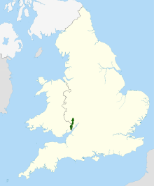
The Wye Valley National Landscape (formerly Area of Outstanding Natural Beauty; Welsh: Dyffryn Gwy) is an internationally important protected landscape straddling the border between England and Wales.
The River Wye (Welsh: Afon Gwy) is the fourth-longest river in the United Kingdom. The upper part passes through Rhayader, Builth Wells and Hay-on-Wye, but the area designated as a National Landscape covers 326 square kilometres (126 sq mi) surrounding a 72-kilometre (45 mi) stretch lower down the river, from just south of Hereford to Chepstow.[1]
This area covers parts of the counties of Gloucestershire, Herefordshire and Monmouthshire, and is recognised in particular for its limestone gorge scenery and dense native woodlands, as well as its wildlife, archaeological and industrial remains. It is also historically important as one of the birthplaces of the modern tourism industry. The area is predominantly rural, and many people make a living from tourism, agriculture or forestry. Ross-on-Wye is the only town within the National Landscape itself, but Hereford, Monmouth, Coleford and Chepstow lie just outside its boundaries.
- ^ "Wye Valley Area of Outstanding Natural Beauty - Management Plan 2004-2009" (PDF). Wye Valley Area of Outstanding Natural Beauty. Retrieved 27 March 2016.
© MMXXIII Rich X Search. We shall prevail. All rights reserved. Rich X Search