Back زلزال سولاوسي 2018 Arabic Linog asin dolnop sa Sulawesi 2018 BCL Zemětřesení a tsunami na Sulawesi 2018 Czech Sulawesi-Erdbeben 2018 German Σεισμός και τσουνάμι στο Σουλαουέζι (2018) Greek Terremoto de Célebes de 2018 Spanish Sulawesi maavärin ja tsunami Estonian زمینلرزه ۲۰۱۸ سولاوسی Persian Sulawesin maanjäristys ja tsunami 2018 Finnish Séisme de 2018 à Célèbes French
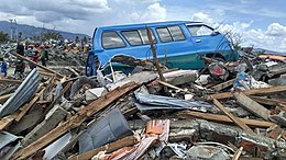
 The village of Petobo after the earthquake. | |
| UTC time | 2018-09-28 10:02:44 |
|---|---|
| ISC event | 616642238 |
| USGS-ANSS | ComCat |
| Local date | 28 September 2018 |
| Local time | 18:02:44 WITA (Indonesia Central Standard Time) |
| Magnitude | 7.5 Mw |
| Depth | 20.0 km (12.4 mi) |
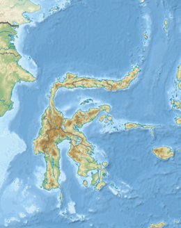
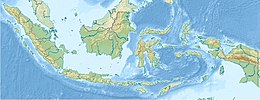
| Epicentre | 0°10′41″S 119°50′24″E / 0.178°S 119.840°E |
| Fault | Palu-Koro fault |
| Type | Strike-slip |
| Max. intensity | MMI X (Extreme) |
| Peak acceleration | >1.54 g[1] |
| Tsunami | Yes (highest 10.7 m (35 ft) in Donggala Regency)[2][3] |
| Landslides | Yes |
| Foreshocks | Mw 5.0–6.1 |
| Aftershocks | 32 (As of 31 December 2018)[4] |
| Casualties | |
On 28 September 2018, a shallow, large earthquake struck in the neck of the Minahasa Peninsula, Indonesia, with its epicentre located in the mountainous Donggala Regency, Central Sulawesi. The magnitude 7.5 quake was located 70 km (43 mi) away from the provincial capital Palu and was felt as far away as Samarinda on East Kalimantan and also in Tawau, Malaysia.[8] This event was preceded by a sequence of foreshocks, the largest of which was a magnitude 6.1 tremor that occurred earlier that day.[9]
Following the mainshock, a tsunami alert was issued for the nearby Makassar Strait.[10] A localised tsunami struck Palu, sweeping shore-lying houses and buildings on its way. The combined effects of the earthquake and tsunami led to the deaths of an estimated 4,340 people.[5][11][12] This makes it the deadliest earthquake to strike the country since the 2006 Yogyakarta earthquake, as well as the deadliest earthquake worldwide in 2018, surpassing the previous earthquake that struck Lombok nearly 2 months earlier, killing more than 500.[13] The Indonesian Agency for Meteorology, Climatology and Geophysics (BMKG) confirmed that a tsunami had been triggered, with its height reaching an estimated maximum of 4 to 7 metres (13 to 23 ft), striking the settlements of Palu, Donggala and Mamuju along its path.[14]
The earthquake caused major soil liquefaction in areas in and around Palu.[15] In two locations this led to mudflows in which many buildings became submerged causing hundreds of deaths with many more missing.[16] The liquefaction was considered to be the largest in the world and was deemed as rare.[17][15]
- ^ Athanasius Cipta; Ariska Rudyanto; Haunan Afif; Rahayu Robiana; Akhmad Solikhin; Amalfi Omang; Supartoyo; Sri Hidayati (2021). "Unearthing the buried Palu–Koro Fault and the pattern of damage caused by the 2018 Sulawesi Earthquake using HVSR inversion". Geological Society, London, Special Publications. 501 (1): 185–203. Bibcode:2021GSLSP.501..185C. doi:10.1144/sp501-2019-70. S2CID 214354800.
- ^ "Tsunami Event: SULAWESI, INDONESIA". ngdc.noaa.gov. Archived from the original on 8 January 2022. Retrieved 8 January 2022.
- ^ "BNPB: Tsunami di Donggala Capai 7 Meter, Lampaui Tiang Listrik". Detik. Archived from the original on 2 October 2018. Retrieved 1 October 2018.
- ^ "USGS earthquake Catalog". United States Geological Survey. Archived from the original on 5 September 2021. Retrieved 5 September 2021.
- ^ a b c Sangadji, Ruslan (30 January 2019). "Central Sulawesi disasters killed 4,340 people, final count reveals". Jakarta Post. Archived from the original on 7 November 2021. Retrieved 18 March 2019.
- ^ ASEAN Coordinating Centre for Humanitarian Assistance on disaster management (3 October 2018). "Situation Update No . 5 M 7.4 Earthquake & Tsunami Sulawesi, Indonesia" (PDF). Archived (PDF) from the original on 3 October 2018. Retrieved 3 October 2018.
- ^ Cite error: The named reference
komp1028was invoked but never defined (see the help page). - ^ "Earthquake and tsunami in Sulawesi, Indonesia – at least 844 people killed". 28 September 2018. Archived from the original on 28 September 2018. Retrieved 28 September 2018.
- ^ Cite error: The named reference
USGSwas invoked but never defined (see the help page). - ^ "Gempabumi Tektonik M=7.7 Kabupaten Donggala, Sulawesi Tengah pada hari Jumat, 28 September 2018, Berpotensi Tsunami". Archived from the original on 20 January 2021. Retrieved 30 September 2018.
- ^ ASEAN Coordinating Centre for Humanitarian Assistance on disaster management (15 October 2018). "Situation Update No. 12 M 7.4 Earthquake & Tsunami Sulawesi, Indonesia" (PDF). Archived (PDF) from the original on 15 October 2018. Retrieved 15 October 2018.
- ^ "Grim search for disaster dead nears its end". 12 October 2018. Archived from the original on 12 October 2018. Retrieved 12 October 2018.
- ^ "Death Toll Tops 1,200 in Worst Indonesian Quake Since 2006". The Edge Markets. Bloomberg News. 2 October 2018. Archived from the original on 3 October 2018. Retrieved 3 October 2018.
- ^ "BMKG Pastikan Tsunami 1,5 Meter hingga 2 Meter Melanda Palu dan Donggala". KOMPAS (in Indonesian). 28 September 2018. Archived from the original on 12 November 2019. Retrieved 28 September 2018.
- ^ a b Mahtani, Shibani; McLaughlin, Timothy; Widianto, Stanley (6 October 2018). "'Not a straightforward event': How multiple disasters stunned experts and ravaged a corner of Indonesia". The Washington Post. Archived from the original on 7 October 2018. Retrieved 7 October 2018.
- ^ Cite error: The named reference
ABC_04_10was invoked but never defined (see the help page). - ^ "BNPB Ungkap Tiga Bencana Indonesia Sebagai Fenomena Langka". CNN Indonesia. Archived from the original on 19 January 2019. Retrieved 19 January 2019.
© MMXXIII Rich X Search. We shall prevail. All rights reserved. Rich X Search


