Back Xeografía de Gales AST ওয়েল্সের ভূগোল Bengali/Bangla Daearyddiaeth Cymru Welsh Geografía de Gales Spanish Géographie du pays de Galles French Ուելսի աշխարհագրություն Armenian Географија на Велс Macedonian Geografia do País de Gales Portuguese География Уэльса Russian 威爾士地理 Chinese
 Map of Wales. Topography above 600 feet (182.88m) in pink; national parks in green. | |
 | |
| Continent | Europe |
|---|---|
| Region | British Isles |
| Area | |
| • Total | 21,218 km2 (8,192 sq mi) |
| Highest point | Snowdon (Welsh: Yr Wyddfa) |
| Longest river | River Severn (Welsh: Afon Hafren) |
| Largest lake | Lake Vyrnwy (Welsh: Llyn Efyrnwy) |
| Climate | Temperate |
| References | |
| [1][2] | |
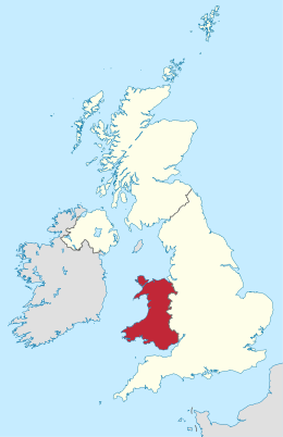
Wales is a country that is part of the United Kingdom and whose physical geography is characterised by a varied coastline and a largely upland interior. It is bordered by England to its east, the Irish Sea to its north and west, and the Bristol Channel to its south. It has a total area of 2,064,100 hectares (5,101,000 acres) and is about 170 mi (274 km) from north to south and at least 60 mi (97 km) wide. It comprises 8.35 percent of the land of the United Kingdom. It has a number of offshore islands, by far the largest of which is Anglesey. The mainland coastline, including Anglesey, is about 1,680 mi (2,704 km) in length. As of 2014, Wales had a population of about 3,092,000; Cardiff is the capital and largest city and is situated in the urbanised area of South East Wales.
Wales has a complex geological history which has left it a largely mountainous country. The coastal plain is narrow in the north and west of the country but wider in the south, where the Vale of Glamorgan has some of the best agricultural land. Exploitation of the South Wales Coalfield during the Industrial Revolution resulted in the development of an urban economy in the South Wales Valleys, and the expansion of the port cities of Newport, Cardiff and Swansea for the export of coal. The smaller North Wales Coalfield was also developed at this time, but elsewhere in the country, the landscape is rural and communities are small, the economy being largely dependent on agriculture and tourism. The climate is influenced by the proximity of the country to the Atlantic Ocean and the prevailing westerly winds; thus it tends to be mild, cloudy, wet and windy.
- ^ "Standard Area Measurements (Latest) for Administrative Areas in the United Kingdom". Open Geography Portal. Office for National Statistics. 24 April 2024. Retrieved 6 May 2024.
- ^ "A Beginners Guide to UK Geography (2023)". Open Geography Portal. Office for National Statistics. 24 August 2023. Retrieved 9 December 2023.
© MMXXIII Rich X Search. We shall prevail. All rights reserved. Rich X Search