Back كامينسك Arabic Kamianské AST Kamyanske Azerbaijani دنیپرودزرژینسک AZB Кам’янскэ Byelorussian Каменскае BE-X-OLD Камянске Bulgarian Kamianskè Catalan Камянске CE Kamians'ke CEB
Kamianske
Кам'янське | |
|---|---|
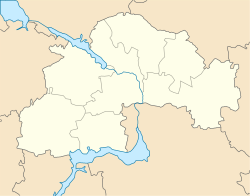
| Coordinates: 48°31′00″N 34°37′00″E / 48.51667°N 34.61667°E | |
| Country | |
| Oblast | Dnipropetrovsk Oblast |
| Raion | Kamianske Raion |
| Hromada | Kamianske urban hromada |
| First mentioned | 1750 |
| Government | |
| • Mayor | Andriy Bilousov |
| Area | |
| • City | 138 km2 (53 sq mi) |
| Elevation | 120 m (390 ft) |
| Population (2022)[1] | |
| • City | 226,845 |
| • Density | 1,600/km2 (4,300/sq mi) |
| • Metro | 238,832 |
| Postal code | 51900 |
| Area code | +380-5692 |
| Website | http://kam.gov.ua/ |
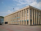
Kamianske (Ukrainian: Кам'янське, IPA: [kɐmjɐnʲˈsʲkɛ] ⓘ), previously known as Dniprodzerzhynsk from 1936 to 2016, is an industrial city in Dnipropetrovsk Oblast, Ukraine, and a port on the Dnieper River. It serves as the administrative center of Kamianske Raion. Kamianske hosts the administration of Kamianske urban hromada, one of the hromadas of Ukraine.[2] Population: 226,845 (2022 estimate).[1]
On 19 May 2016, it was renamed back to its historical name of Kamianske.[3] Along with the city's name change, the city's hydroelectric station was renamed to Middle Dnieper Hydroelectric Power Plant.
Besides the hydroelectric station, the city houses a few other industrial enterprises: Prydniprovsky Chemical Plant (closed in 1991), Bahley Coke Factory and Dnieper Metallurgical Combine.
- ^ a b Чисельність наявного населення України на 1 січня 2022 [Number of Present Population of Ukraine, as of January 1, 2022] (PDF) (in Ukrainian and English). Kyiv: State Statistics Service of Ukraine. Archived (PDF) from the original on July 4, 2022.
- ^ "Каменская городская громада" (in Russian). Портал об'єднаних громад України.
- ^ "Dniprodzerzhynsk renamed Kamianske". www.unian.info. Retrieved December 30, 2018.
© MMXXIII Rich X Search. We shall prevail. All rights reserved. Rich X Search


