Back Calais Afrikaans Calais ALS Calais AN كاليه Arabic كاليه ARZ Calais AST Kale Azerbaijani کاله (فرانسه) AZB Кале Byelorussian Кале BE-X-OLD
Calais
Calés (Picard) | |
|---|---|
Subprefecture and commune | |
| Coordinates: 50°56′53″N 01°51′23″E / 50.94806°N 1.85639°E | |
| Country | France |
| Region | Hauts-de-France |
| Department | Pas-de-Calais |
| Arrondissement | Calais |
| Canton | Calais-1, 2 and 3 |
| Intercommunality | CA Grand Calais Terres et Mers |
| Government | |
| • Mayor (2020–2026) | Natacha Bouchart[1] (LR) |
| Area 1 | 33.5 km2 (12.9 sq mi) |
| Population (2021)[2] | 67,380 |
| • Density | 2,000/km2 (5,200/sq mi) |
| Demonym | Calaisiens |
| Time zone | UTC+01:00 (CET) |
| • Summer (DST) | UTC+02:00 (CEST) |
| INSEE/Postal code | 62193 /62100 |
| Elevation | 0–18 m (0–59 ft) |
| Website | City; Port |
| 1 French Land Register data, which excludes lakes, ponds, glaciers > 1 km2 (0.386 sq mi or 247 acres) and river estuaries. | |
Calais (UK: /ˈkæleɪ/ KAL-ay, US: /kæˈleɪ/ kal-AY,[3][4] traditionally /ˈkælɪs/ KAL-iss, French: [kalɛ] ⓘ)[a] is a port city in the Pas-de-Calais department, of which it is a subprefecture.[5] Although Calais is by far the largest city in Pas-de-Calais, the department's prefecture is its third-largest city of Arras. The population of the city proper is 67,544; that of the urban area is 144,625 (2020).[6] Calais overlooks the Strait of Dover, the narrowest point in the English Channel, which is only 34 km (21 mi) wide here, and is the closest French town to England. The White Cliffs of Dover can easily be seen on a clear day from Calais. Calais is a major port for ferries between France and England, and since 1994, the Channel Tunnel has linked nearby Coquelles to Folkestone by rail.
Because of its position, Calais has been a major port and an important centre for transport and trading with England since the Middle Ages. Calais came under English control after Edward III of England captured the city in 1347, followed by a treaty in 1360 that formally assigned Calais to English rule. Calais grew into a thriving centre for wool production, and came to be called the "brightest jewel in the English crown" because of its importance as the gateway for the tin, lead, lace and wool trades (or "staples"). Calais remained under English control until its recapture by France in 1558.
During World War II, the town was virtually razed to the ground: in May 1940, it was a strategic bombing target of the invading German forces who took it during the siege of Calais. The Germans built massive bunkers along the coast in preparation for launching missiles at England.
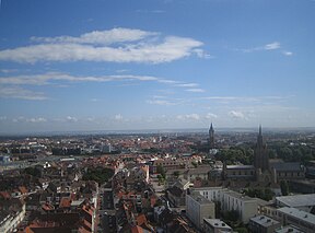
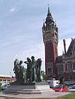
The old part of the town, Calais-Nord, is on an artificial island surrounded by canals and harbours. The modern part of the town, St-Pierre, lies to the south and south-east. In the centre of the old town is the Place d'Armes, in which stands the Tour du Guet, or watch-tower, a structure built in the 13th century, which was used as a lighthouse until 1848 when a new lighthouse was built by the port. South east of the Place is the church of Notre-Dame, built during the English occupancy of Calais. Arguably, it is the only church built in the English perpendicular style in all of France. In this church, former French President Charles de Gaulle married Yvonne Vendroux. South of the Place and opposite the Parc St Pierre is the Hôtel-de-ville (the town hall), and the belfry from the early 20th century. Today, Calais is visited by more than 10 million annually. Aside from being a key transport hub, Calais is also a notable fishing port and a centre for fish marketing, and some 3,000 people are still employed in the lace industry for which the town is also famed.
- ^ "Répertoire national des élus: les maires" (in French). data.gouv.fr, Plateforme ouverte des données publiques françaises. 6 June 2023.
- ^ "Populations légales 2021". The National Institute of Statistics and Economic Studies. 28 December 2023.
- ^ Wells, John C. (2008). Longman Pronunciation Dictionary (3rd ed.). Longman. ISBN 978-1-4058-8118-0.
- ^ Jones, Daniel (2011). Roach, Peter; Setter, Jane; Esling, John (eds.). Cambridge English Pronouncing Dictionary (18th ed.). Cambridge University Press. ISBN 978-0-521-15255-6.
- ^ INSEE commune file
- ^ Comparateur de territoire: Aire d'attraction des villes 2020 de Calais (073), Commune de Calais (62193), INSEE
Cite error: There are <ref group=lower-alpha> tags or {{efn}} templates on this page, but the references will not show without a {{reflist|group=lower-alpha}} template or {{notelist}} template (see the help page).
© MMXXIII Rich X Search. We shall prevail. All rights reserved. Rich X Search


