Back Neiva Afrikaans نيفا (كولومبيا) Arabic Neiva AVK Neyva Azerbaijani Нейва (Калумбія) Byelorussian Нейва Bulgarian Neiva Catalan Neiva (munisipyo) CEB Neiva German Neiva Esperanto
Neiva | |
|---|---|
Municipality and city | |
| Municipio de Neiva | |
|
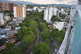
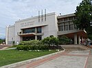
From the top: Neiva skyline, José Eustasio Rivera convention center, Cacica La Gaitana monument, La Bambuquera monument, Contemporary art of Huila museum. | |
| Nickname: La capital del río Magdalena (Magdalena River's Capital) | |
 Location in the Huila Department. Urban in red, municipality in dark gray | |
| Coordinates: 2°56′04.14″N 75°16′51.24″W / 2.9344833°N 75.2809000°W | |
| Country | |
| Region | Andean |
| Department | Huila |
| Foundation | May 24, 1612 |
| Government | |
| • Mayor | Gorky Muñoz Calderón |
| Area | |
| • Municipality and city | 1,270 km2 (490 sq mi) |
| • Urban | 47.29 km2 (18.26 sq mi) |
| Elevation | 442 m (1,450 ft) |
| Population | |
| • Municipality and city | 357,392 |
| • Density | 280/km2 (730/sq mi) |
| • Urban | 335,994 |
| • Urban density | 7,100/km2 (18,000/sq mi) |
| Demonym | Neivano |
| Time zone | UTC-05 (Eastern Time Zone) |
| Postal code | 410001-18 |
| Area code | 57 + 8 |
| Anthem | "Hoy a Neiva Cantad Corazones" |
| Website | Official website (in Spanish) |
Neiva (Spanish pronunciation: [ˈnejβa]) is the capital of the Department of Huila. It is located in the valley of the Magdalena River in south central Colombia with a municipal population of 357,392.[1] It is one of the most important cities in southern Colombia, mainly because of its strategic geographical location.
- ^ a b Informacion capital DANE 2019
- ^ Citypopulation.de Population of Neiva municipality with localities
© MMXXIII Rich X Search. We shall prevail. All rights reserved. Rich X Search


