Back Balmain (bahin nga lungsod) CEB بالمین، نیو ساوت ولز Persian Balmain (Australie) French Balmain, New South Wales ID Balmain Malagasy Balmain, New South Wales Malay Balmain Polish Balmain, New South Wales Romanian Balmain Swedish بالمین، نیوساؤتھ ویلز Urdu
| Balmain Sydney, New South Wales | |||||||||||||||
|---|---|---|---|---|---|---|---|---|---|---|---|---|---|---|---|
 | |||||||||||||||
| Coordinates | 33°51′32″S 151°10′45″E / 33.85895°S 151.17906°E | ||||||||||||||
| Population | 10,454 (SAL 2021)[1] | ||||||||||||||
| Established | 1836 | ||||||||||||||
| Postcode(s) | 2041 | ||||||||||||||
| Elevation | 49 m (161 ft) | ||||||||||||||
| Area | 1.5 km2 (0.6 sq mi) | ||||||||||||||
| Location | 5 km (3 mi) west of Sydney CBD | ||||||||||||||
| LGA(s) | Inner West Council | ||||||||||||||
| State electorate(s) | Balmain | ||||||||||||||
| Federal division(s) | Grayndler | ||||||||||||||
| |||||||||||||||
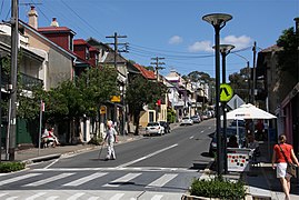
Balmain is a suburb in the Inner West[2] of Sydney, New South Wales, Australia. Balmain is located two kilometres (1+1⁄4 miles) west of the Sydney central business district, in the local government area of the Inner West Council.
It is located on the Balmain peninsula surrounded by Port Jackson, adjacent to the suburbs of Rozelle to the south-west, Birchgrove to the north-west, and Balmain East to the east. Iron Cove sits on the western side of the peninsula, with White Bay on the south-east side and Mort Bay on the north-east side.
Traditionally blue collar, Balmain was where the industrial roots of the trade unionist movement began. It has become established in Australian working-class culture and history, due to being the place where the Australian Labor Party formed in 1891 and its social history and status is of high cultural significance to both Sydney and New South Wales. Today, the ALP contends with the Australian Greens for political prominence in Balmain, and Kobi Shetty of the Greens holds the State seat of Balmain.
- ^ Australian Bureau of Statistics (28 June 2022). "Balmain (suburb and locality)". Australian Census 2021 QuickStats. Retrieved 28 June 2022.
- ^ Australian Suburb Guide: Sydney Inner West Archived 26 December 2012 at the Wayback Machine Retrieved 7 August 2013.
© MMXXIII Rich X Search. We shall prevail. All rights reserved. Rich X Search

