Back مقاطعة أورانج (نيويورك) Arabic اورئینج بؤلگهسی، نیویورک AZB Orange County, New York BAR Ориндж (окръг, Ню Йорк) Bulgarian ওরেঞ্জ কাউন্টি, নিউ ইয়র্ক BPY Comtat d'Orange (Nova York) Catalan Orange Gông (New York) CDO Ориндж (гуо, Нью-Йорк) CE Orange County (kondado sa Tinipong Bansa, New York) CEB Orange County (New York) Czech
Orange County | |
|---|---|
 Island Pond in Harriman State Park, near the Village of Harriman. | |
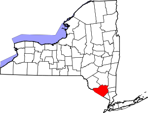
 Location within the U.S. state of New York | |
 New York's location within the U.S. | |
| Coordinates: 41°24′N 74°19′W / 41.4°N 74.31°W | |
| Country | |
| State | |
| Founded | November 1, 1683[a] |
| Named for | William III of Orange |
| Seat | Goshen |
| Largest town | Palm Tree[2] |
| Government | |
| • County Executive | Steven M. Neuhaus (R) |
| Area | |
| • Total | 839 sq mi (2,170 km2) |
| • Land | 812 sq mi (2,100 km2) |
| • Water | 27 sq mi (70 km2) 3.2% |
| Population (2020) | |
| • Total | 401,310[1] |
| • Estimate (2023)[3] | 407,470 |
| Time zone | UTC−5 (Eastern) |
| • Summer (DST) | UTC−4 (EDT) |
| Area code | 845 |
| Congressional district | 18th |
| Website | www |
Orange County is a county located in the U.S. state of New York. As of the 2020 census, the population was 401,310. The county seat is Goshen.[4] This county was first created in 1683 and reorganized with its present boundaries in 1798.[5] The county is part of the Hudson Valley region of the state.
Orange County is part of the Poughkeepsie–Newburgh–Middletown metropolitan statistical area,[6] which belongs to the larger New York–Newark–Bridgeport, NY–NJ–CT–PA Combined Statistical Area.
As of the 2010 census the center of population of the state of New York was located in Orange County, approximately 3 mi (4.8 km) west of the hamlet of Westbrookville.[7]
- ^ "U.S. Census Bureau QuickFacts: Orange County, New York". Archived from the original on April 13, 2020. Retrieved May 15, 2018.
- ^ "Orange County's population soars".
- ^ "QuickFacts: Orange County, New York". Census.gov. Retrieved July 7, 2022.
- ^ "Find a County". National Association of Counties. Archived from the original on May 3, 2015. Retrieved June 7, 2011.
- ^ "New York: Individual County Chronologies". New York Atlas of Historical County Boundaries. The Newberry Library. 2008. Archived from the original on April 10, 2015. Retrieved January 10, 2015.
- ^ United States Office of Management and Budget (September 14, 2018). "OMB Bulletin No. 18-04" (PDF). Retrieved July 11, 2019.
- ^ "Center of population of New York as of 2010 census (Google Maps)". Retrieved July 5, 2016.
Cite error: There are <ref group=lower-alpha> tags or {{efn}} templates on this page, but the references will not show without a {{reflist|group=lower-alpha}} template or {{notelist}} template (see the help page).
© MMXXIII Rich X Search. We shall prevail. All rights reserved. Rich X Search


