Back Estat de Pudukkottai Catalan Pudukkottai (Staat) German Pudukkottai (stato) Italian Пудуккоттай (княжество) Russian புதுக்கோட்டை சமஸ்தானம் Tamil ریاست پوڈوکوٹائی Urdu
Kingdom of Pudukkottai Princely State of Pudukkottai | |||||||||||
|---|---|---|---|---|---|---|---|---|---|---|---|
| 1680–1948 | |||||||||||
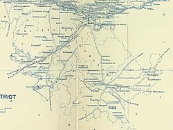
 Map of Pudukkottai | |||||||||||
| Status | Kingdom of Pudukkottai (Subordinate to Ramnad until 1680). Princely state under the paramountcy of the British Raj (1800–1948) | ||||||||||
| Capital | Pudukkottai | ||||||||||
| Common languages | Tamil, English | ||||||||||
| Religion | Hindu | ||||||||||
| Government | Principality | ||||||||||
| Ruler | |||||||||||
• (first)1680–1730 | Raghunatha Raya Tondaiman | ||||||||||
• (last)1928–1948 | Rajagopala Tondaiman | ||||||||||
| History | |||||||||||
• Established | 1680 | ||||||||||
• Earliest records | 1680 | ||||||||||
• Disestablished | 1 March 1948 | ||||||||||
| Area | |||||||||||
| 1941 | 3,050 km2 (1,180 sq mi) | ||||||||||
| Population | |||||||||||
• 1941 | 438,648 | ||||||||||
| |||||||||||
| Today part of | Tamil Nadu, India | ||||||||||

Pudukkottai was a kingdom and later a princely state in British India, which existed from 1680 until 1948.
The Kingdom of Pudukkottai was founded in about 1680 as a feudatory of Ramnad and grew with subsequent additions from Tanjore, Sivaganga and Ramnad. One of the staunch allies of the British East India Company in the Carnatic, Anglo-Mysore and Polygar wars, the kingdom was brought under the Company's protection in 1800 as per the system of Subsidiary Alliance. The state was placed under the control of the Madras Presidency from 1800 until 1 October 1923, when the Madras States Agency was abolished, and until 1948 it was under the political control of the Government of India.
Pudukkottai State covered a total area of 1,178 square miles (3,050 km2) and had a population of 438,648 in 1941. It extended over the whole of the present-day Pudukkottai district of Tamil Nadu (with the exception of Aranthangi taluk which was then a part of Tanjore district). The town of Pudukkottai was its capital. The ruler of Pudukkottai was entitled to a 17-gun salute.
© MMXXIII Rich X Search. We shall prevail. All rights reserved. Rich X Search

