Back مقاطعة سوليفان (نيويورك) Arabic سوليڤان كاونتى (نيو يورك) ARZ Sullivan County, New York BAR Съливан (окръг, Ню Йорк) Bulgarian সুল্লিভান কাউন্টি, নিউ ইয়র্ক BPY Sullivan Gông (New York) CDO Салливан (гуо, Нью-Йорк) CE Sullivan County (kondado sa Tinipong Bansa, New York) CEB Sullivan County (New York) Czech Sullivan County, Efrog Newydd Welsh
Sullivan County | |
|---|---|
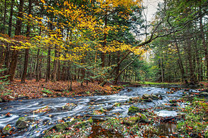
 Stream in the hamlet of Rock Hill | |
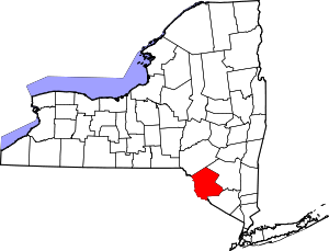
 Location within the U.S. state of New York | |
 New York's location within the U.S. | |
| Coordinates: 41°43′N 74°46′W / 41.72°N 74.76°W | |
| Country | |
| State | |
| Founded | 1809 |
| Named for | John Sullivan |
| Seat | Monticello |
| Largest village | Monticello |
| Area | |
| • Total | 997 sq mi (2,580 km2) |
| • Land | 968 sq mi (2,510 km2) |
| • Water | 29 sq mi (80 km2) 2.9% |
| Population (2020) | |
| • Total | 78,624 [1] |
| • Density | 81.2/sq mi (31.4/km2) |
| Time zone | UTC−5 (Eastern) |
| • Summer (DST) | UTC−4 (EDT) |
| Congressional district | 19th |
| Website | sullivanny |
Sullivan County is a county in the U.S. state of New York. As of the 2020 census, the population was 78,624.[2] The county seat is Monticello.[3] The county's name honors Major General John Sullivan, who was labeled at the time as a hero in the American Revolutionary War in part due to his successful campaign against the Iroquois (see Sullivan Expedition). The county is part of the Hudson Valley region of the state.
The county was the site of hundreds of Borscht Belt hotels and resorts, which had their heyday from the 1920s through the 1970s.
In 2010, the state's center of population was at the southern edge of Sullivan County.[4]
- ^ "US Census 2020 Population Dataset Tables for New York". United States Census Bureau. Retrieved January 2, 2022.
- ^ "U.S. Census Bureau QuickFacts: Sullivan County, New York". United States Census Bureau. Retrieved January 2, 2022.
- ^ "Find a County". National Association of Counties. Retrieved June 7, 2011.
- ^ "Centers of Population by State: 2010". United States Census Bureau. Retrieved April 5, 2014.
© MMXXIII Rich X Search. We shall prevail. All rights reserved. Rich X Search

