Back يوجي (كيوتو) Arabic اوجی، کیوتو AZB উজি, কিয়োটা Bengali/Bangla Uji Catalan Удзи CE Udži (Kjóto) Czech Uji (Kyōto) German Uĝi Esperanto Uji (Kioto) Spanish Uji (Kyoto) Basque
You can help expand this article with text translated from the corresponding article in Japanese. Click [show] for important translation instructions.
|
Uji
宇治市 | |
|---|---|
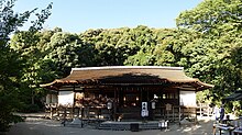
 Byōdō-in, a World Heritage Site | |
 Location of Uji in Kyoto Prefecture | |
| Coordinates: 34°53′4″N 135°47′59″E / 34.88444°N 135.79972°E | |
| Country | Japan |
| Region | Kansai |
| Prefecture | Kyoto Prefecture |
| First official recorded | early 5th century |
| City Settled | March 1, 1951 |
| Government | |
| • Mayor | Atsuko Matsumura |
| Area | |
| • Total | 67.54 km2 (26.08 sq mi) |
| Population (October 1, 2020) | |
| • Total | 179,630 |
| • Density | 2,700/km2 (6,900/sq mi) |
| Time zone | UTC+9 (Japan Standard Time) |
| Tree | Acer |
| Flower | Kerria japonica |
| Bird | Alcedo atthis |
| Phone number | 0774-22-3141 |
| Address | 33 Uji Biwa, Uji-shi, Kyōto-fu 611-8501 |
| Website | www |


Uji (宇治市, Uji-shi) is a city on the southern outskirts of the city of Kyoto, in Kyoto Prefecture, Japan.
Founded on March 1, 1951, Uji is between the two ancient capitals of Nara and Kyoto. The city sits on the Uji River, which has its source in Lake Biwa.
As of 1 October 2020[update] Uji has a population of 179,630 and is the second largest city in Kyoto Prefecture. It has an area of 67.54 km2, giving it a population density of 2,660 persons per km2.[1]
© MMXXIII Rich X Search. We shall prevail. All rights reserved. Rich X Search


