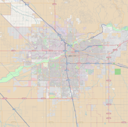
East Bakersfield | |
|---|---|
| Coordinates: 35°22′59″N 118°59′6″W / 35.38306°N 118.98500°W | |
| Country | United States |
| State | California |
| County | County of Kern |
| City | City of Bakersfield |
| Founded | 1876 |
| Incorporated | 1892 |
| Annexed | 1910 |
| Subdistricts of East Bakersfield | List
|
| Area | |
| • Total | 4.00 sq mi (10.4 km2) |
| ZIP Code | 93305 |
| Area Code | 661 |
East Bakersfield is a region in Bakersfield, California directly east of downtown. The region was formerly known as the town of Sumner, which was later incorporated and renamed Kern City. It is primarily a mixture of residential and commercial developments. It also contains a small business district (which was the downtown for Kern City) centered on the intersection of Baker and Sumner streets. Census data is provided on the right for the time period when the region was an independent town and city. It is part of the Bakersfield urban area of almost 500,000 people.
The area known as East Bakersfield includes land that is both part of Bakersfield city limits and unincorporated areas. The unincorporated area's population is approximately 55,000, and has large Hispanic and African American populations. The major school districts in East Bakersfield are the Bakersfield City School District and the Kern Union High School District. East Bakersfield has four high schools, Highland High School, East Bakersfield High School Foothill High School, and Mira Monte High School.
© MMXXIII Rich X Search. We shall prevail. All rights reserved. Rich X Search

