Back Sambisa-Sümpfe German جنگل سامبیسا Persian Forêt de Sambisa French Dajin Sambisa Hausa Hutan Sambisa ID Sambisa Forest Yoruba
| Sambisa Forest | |
|---|---|
 | |
| Map | |
 Location of Sambisa Forest in Borno State | |
| Geography | |
| Location | Sambisa, Borno, Nigeria |
| Coordinates | 11°15′00″N 13°25′00″E / 11.25°N 13.4167°E[1] |
| Elevation | 359 metres (1,178 ft) |
| Area | 518 km2 [2] |
| Administration | |
| Governing body | |
| Ecology | |
| Forest cover | Western Sudanese savannah |
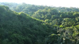
The Sambisa Forest is a forest in Borno State, northeast Nigeria. It is in the southwestern part of Chad Basin National Park, about 60 km southeast of Maiduguri, the capital of Borno State. It has an area of 518 km2.[3][4]
- ^ (2015) factsheet: Sambisa Game Reserve BirdLife International, Important Bird Areas; retrieved 2 May 2015
- ^ "Once Upon a Game Reserve: Sambisa and the Tragedy of a Forested Landscape". Environment and Society Portal. 1 September 2014. Retrieved 15 August 2022.
- ^ "Sambisa Forest: Behind Enemy Lines". Daily Trust. 28 January 2022. Retrieved 15 August 2022.
- ^ "How safe is Sambisa forest now?". Vanguard. 20 April 2017. Retrieved 15 August 2022.
© MMXXIII Rich X Search. We shall prevail. All rights reserved. Rich X Search