Back География на Англия Bulgarian ইংল্যান্ডের ভূগোল Bengali/Bangla Geografía de Inglaterra Spanish Géographie de l'Angleterre French इंग्लैंड का भूगोल Hindi Անգլիայի աշխարհագրություն Armenian Geografi Inggris ID イングランドの地理 Japanese Anglijos geografija Lithuanian Географија на Англија Macedonian
 Satellite image including England | |
 | |
| Continent | Europe |
|---|---|
| Region | British Isles |
| Area | |
| • Total | 132,930 km2 (51,320 sq mi) |
| Coastline | 3,200 km (2,000 mi) |
| Borders | |
| Highest point | Scafell Pike 978 m (3,209 ft) |
| Lowest point | Holme Fen, −2.75 m (−9 ft) |
| Longest river | River Severn (shared with Wales) 354 km (220 mi) Longest river entirely within England is the River Thames. 346 km (215 mi) |
| Largest lake | Windermere 14.73 km2 (5.69 sq mi) |
| Climate | Oceanic "British" climate with small areas of Subarctic climate |
| Terrain | Mostly low hills and plains, especially in the south, Midlands and east. Upland or mountainous terrain prevails in the north and parts of the west. |
| Natural resources | Iron, zinc, potash, silica sand, fish, timber, wildlife, petroleum, natural gas, hydropower, wind power, lead, tin, copper, china clay, arable land, and coal |
| Natural hazards | European windstorms, floods, few and small tornadoes |
| Environmental issues | climate change, rising sea levels, renewable energy, waste disposal, water pollution, population density |
| References | |
| [1][2] | |
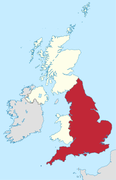
England comprises most of the central and southern two-thirds of the island of Great Britain, in addition to a number of small islands of which the largest is the Isle of Wight. England is bordered to the north by Scotland and to the west by Wales. It is closer to continental Europe than any other part of mainland Britain, divided from France only by a 33 km (21 mi) sea gap, the English Channel.[3] The 50 km (31 mi) Channel Tunnel,[4] near Folkestone, directly links England to mainland Europe. The English/French border is halfway along the tunnel.[5]
Most of England consists of low hills and plains, with upland and mountainous terrain in the north and west. Uplands in the north include the Pennines, an upland chain dividing east and west, the Lake District, containing the highest mountains in the country, the Cheviot Hills across the Anglo-Scottish border, and the North York Moors near the North Sea. Uplands in the west include Dartmoor and Exmoor in the south west and the Shropshire Hills near Wales. The approximate dividing line between terrain types is often indicated by the Tees–Exe line. To the south of that line, there are larger areas of flatter land, including East Anglia and the Fens, although hilly areas include the Cotswolds, the Chilterns, and the North and South Downs.
The largest natural harbour in England is at Poole, on the south-central coast. Some regard it as the second largest harbour in the world, after Sydney, Australia, although this fact is disputed (see harbours for a list of other large natural harbours).
- ^ "Standard Area Measurements (Latest) for Administrative Areas in the United Kingdom (V2)". Open Geography Portal. Office for National Statistics. 5 April 2023. Retrieved 3 December 2023.
- ^ "A Beginners Guide to UK Geography (2023)". Open Geography Portal. Office for National Statistics. 24 August 2023. Retrieved 9 December 2023.
- ^ Dornbusch, U (October 2002). "CoastView – What happens offshore?". University of Sussex. Retrieved 29 October 2012.
- ^ "Archived copy". Archived from the original on 17 July 2015. Retrieved 29 October 2012.
{{cite web}}: CS1 maint: archived copy as title (link) - ^ "TravelBritain – Kent". Archived from the original on 7 September 2008.
© MMXXIII Rich X Search. We shall prevail. All rights reserved. Rich X Search