Back نهر دارينت ARZ River Darent CEB Afon Darent Welsh River Darent German Darent Finnish Darent Italian ダレント川 Japanese Darent Dutch Darent NN Darent NB
| River Darent | |
|---|---|
 Confluence of Darent (left) and Cray rivers, viewed from Crayford Marshes, towards Temple Hill | |
| Physical characteristics | |
| Source | |
| • location | Hills south of Westerham TQ 450 519 |
| • coordinates | 51°14′53″N 0°04′26″E / 51.247917°N 0.073981°E |
| Mouth | |
• location | River Thames TQ 541 780 |
• coordinates | 51°28′48″N 0°13′12″E / 51.479887°N 0.220133°E |
| Length | 20 miles (32 km) |

The Darent is a Kentish tributary of the River Thames and takes the waters of the River Cray as a tributary in the tidal portion of the Darent near Crayford. 'Darenth' is frequently found as the spelling of the river's name in older books and maps, Bartholomew's Canals and River of England being one example. Bartholomew's Gazetteer (1954) demonstrates that Darent means "clear water", a result of it springing from and running through chalk. The purity of the water was a major factor in the development of paper and pharmaceuticals in the area.
Darenth Parish (through which the river flows) derives from a Celtic phrase 'stream where oak-trees grow' (Irish: "dair" = 'oak-tree', "abha" = river)[1](compare e.g."Derwent"). The landscapes of the valley were painted in a visionary manner by the Victorian artist Samuel Palmer during the mid-1800s.
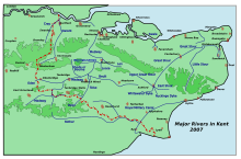
Fed by springs from the greensand hills south of Westerham in Kent[2] and below Limpsfield Chart in Surrey, the Darent flows 21 miles (34 km) east then north by Otford and Shoreham, past the castle and the ruined Roman villa at Lullingstone, then by Eynsford, Farningham, Horton Kirby, South Darenth, Sutton-at-Hone, Darenth, and eventually to Dartford, whence it proceeds a final two miles as a tidal estuary until it drops into the Thames at Long Reach.[3]
North of Dartford, the Darent is tidal and, just before entering the Thames, receives the waters of the River Cray at Dartford & Crayford Marshes where the rivers form administrative boundaries between Greater London and Kent, (specifically, the London Borough of Bexley and the Kentish borough of Dartford). The Darent enters Long Reach to the east of Crayford Ness.[4][5][6]
Kent County Council has signposted a 19-mile (31 km) walking route[7] along the Darent between the Greensand Hills above Sevenoaks and the Thames[8] and named it the Darent Valley Path. The route receives no obvious attention from councils or 'focus' groups[citation needed] although all or part is used by joggers, cyclists, walkers, dog walkers and curious adventurers, availing themselves of the Darent Valley Path to access or view the river's amenities, such as they are.[citation needed] This lack of attention is being addressed in the tidal section by a group of concerned locals, the "Friends of Dartford and Crayford Creeks".[9] As of mid-2016[update], a trust was being formed to promote regeneration and give formal recognition to the protection of this valuable public amenity.[citation needed]
- ^ Dinneen, Patrick (1959), Concise English-Irish Dictionary, M.H. Gill & Son, Dublin
- ^ Explorer 147 Sevenoaks & Tonbridge (Map) (Get-a-Map online ed.). Ordnance Survey. Archived from the original on 29 June 2011. Retrieved 20 November 2011.
- ^ "Long Reach - WHERE THAMES SMOOTH WATERS GLIDE".
- ^ Hadfield, Charles (1983). The Canals of South and South East England. pp. 57–58. ISBN 0-7153-4693-8.
- ^ Wood, Frederick G (1969). Let's Explore the River Darent. Gillingham, UK: Meresborough Books. ISBN 0-905270-77-0.
- ^ "Archived copy" (PDF). Archived from the original (PDF) on 26 July 2008. Retrieved 16 December 2007.
{{cite web}}: CS1 maint: archived copy as title (link) - ^ "The Darent Valley". Archived from the original on 20 February 2013.
- ^ "Darent Valley Path".
- ^ "Friends of Dartford and Crayford Creek | Facebook". Facebook.com. Retrieved 2 July 2022.
© MMXXIII Rich X Search. We shall prevail. All rights reserved. Rich X Search