Back تشيستر (كونيتيكت) Arabic تشيستر (كونيتيكت) ARZ Chester, Connecticut BAR Chester (Connecticut) Catalan Честер (Коннектикут) CE Chester, Connecticut Welsh Chester (Connecticut) German Chester (Connecticut) Spanish Chester (Connecticut) Basque چستر، کنکتیکت Persian
Chester, Connecticut | |
|---|---|
| Town of Chester | |
 The Old Town Hall | |
| Coordinates: 41°24′08″N 72°28′57″W / 41.40222°N 72.48250°W | |
| Country | |
| U.S. state | |
| County | Middlesex |
| Region | Lower CT River Valley |
| Incorporated | 1836 |
| Government | |
| • Type | Selectman-town meeting |
| • First selectman | Charlene Janacek |
| Area | |
| • Total | 16.8 sq mi (43.5 km2) |
| • Land | 16.0 sq mi (41.5 km2) |
| • Water | 0.8 sq mi (2.1 km2) |
| Elevation | 377 ft (115 m) |
| Population (2020) | |
| • Total | 3,749 |
| • Density | 220/sq mi (86/km2) |
| Time zone | UTC-5 (EST) |
| • Summer (DST) | UTC-4 (EDT) |
| ZIP code | 06412 |
| Area code(s) | 860/959 |
| FIPS code | 09-14300 |
| GNIS feature ID | 0213407[1] |
| Website | www |
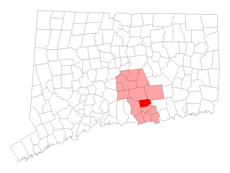
Chester is a town in Middlesex County, Connecticut, United States. The town is part of the Lower Connecticut River Valley Planning Region. The population was 3,749 at the 2020 census.[2] The town center is defined by the U.S. Census Bureau as a census-designated place (CDP). The name is a transfer from Chester, in England.[3]
- ^ a b U.S. Geological Survey Geographic Names Information System: Chester, Connecticut
- ^ "Census - Geography Profile: Chester town, Middlesex County, Connecticut". Retrieved November 27, 2021.
- ^ The Connecticut Magazine: An Illustrated Monthly. Connecticut Magazine Company. 1903. p. 331.
© MMXXIII Rich X Search. We shall prevail. All rights reserved. Rich X Search


