Back Meiji Jiao (kagaangan sa Pangmasang Republika sa Tśina) CEB Mischief Reef Czech Mischief-Riff German Arrecife Mischief Spanish Récif Mischief French Karang Mischief ID ミスチーフ礁 Japanese 미스치프 암초 Korean Mischief Reef Swedish Đá Vành Khăn Vietnamese
You can help expand this article with text translated from the corresponding article in Chinese. (February 2019) Click [show] for important translation instructions.
|
| Disputed atoll | |
|---|---|
 Mischief Reef in 2022 | |
| Other names | 美濟礁 / 美济礁 Měijì Jiāo (Chinese) Panganiban Reef (Philippine English) Bahura ng Panganiban (Filipino) Đá Vành Khăn (Vietnamese) |
| Geography | |
| Location | South China Sea |
| Coordinates | 9°55′N 115°32′E / 9.917°N 115.533°E |
| Archipelago | Spratly Islands |
| Administration | |
| Province | Hainan |
| prefecture-level city | Sansha |
| Claimed by | |
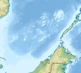
Mischief Reef, also known as Panganiban Reef[1] (Filipino: Bahura ng Panganiban; Vietnamese: Đá Vành Khăn; Mandarin Chinese: 美濟礁/美济礁; pinyin: Měijì Jiāo; lit. 'Meiji Reef'), is a low tide elevation (LTE) reef/atoll surrounding a large lagoon in the SE of Dangerous Ground in the east of the Spratly Islands in the South China Sea. It is located 250 kilometres (130 nmi) west of Palawan Island of the Philippines. Administratively, it belonged to the Kalayaan Islands municipality of the province of Palawan.[2] It is also under the de facto jurisdiction of Nansha islands, Sansha City, Hainan province, China. Activities by the People's Republic of China (PRC) in the mid-2010s have created a large artificial island on the atoll including an approximately 2,700-metre (8,900 ft) runway and associated airfield.
Although the reef is well within the Philippines' exclusive economic zone (EEZ) and traditional fishing grounds, Mischief Reef has been controlled by the PRC since 1995, and is also claimed by the Republic of China (Taiwan), and Vietnam. The PRC performed various reclamation activities in at least two locations on the rim of the atoll in the period from 1995 to 2013. However, from the end of 2013 to the end of 2016 a large artificial island of 1,379 acres (558 ha) was created around the majority of the lagoon's perimeter.[3]
The reef was the subject of a 2016 tribunal ruling by the Permanent Court of Arbitration in The Hague, where the landmark ruling the nine-dash line as moot and without basis. Mischief Reef was also ruled as a low tide elevation (LTE) meaning it cannot possess a territorial 12 mile-boundary regardless of the reclamation and a military base installation by the PRC. Their moves only heightened the tension with the Philippines, resulting to a massive defense acquisition of this archipelagic nation.
The area is said[4] to be rich in as of yet unexplored oil and gas fields.[5]
- ^ "The battle for Mischief Reef". Warfighter.org. Archived from the original on 20 August 2016. Retrieved 27 November 2013.
- ^ "Map of Mischief reef". Wikimapia. Retrieved 17 March 2014.
- ^ Mischief Reef Tracker, amti.csis.org
- ^ Raman, B (1999). Chinese Territorial Assertions: The Case of the Mischief Reef. Chennai, India: Institute For Topical Studies. Archived from the original on 20 August 2016. Retrieved 27 November 2013.
- ^ Meyer, Lt Col. Stanley E (1996). Incident at Mischief reef : Implications for The Philippines, China and The United States (PDF). Pennsylvania, USA: US Army war college, Carlisle barracks. Archived from the original on 3 December 2013.
© MMXXIII Rich X Search. We shall prevail. All rights reserved. Rich X Search
