Back Bolton (lungsod sa Kanada) CEB Bolton (Ontario) German Bolton (Ontario) Spanish بولتون، انتاریو Persian Bolton (Ontario) French Bolton (Ontario) Italian Bolton, Ontario Swedish
Bolton | |
|---|---|
 Queen Street (Highway 50) in Bolton | |
| Coordinates: 43°52′50″N 79°44′17″W / 43.88056°N 79.73806°W | |
| Country | Canada |
| Province | Ontario |
| Regional municipality | Peel |
| Town | Caledon |
| Ward | 5 |
| Area | |
| • Land | 20.71 km2 (8.00 sq mi) |
| Population | |
| • Total | 26,795 |
| • Density | 1,294.0/km2 (3,351/sq mi) |
| Time zone | UTC-5 (EST) |
| • Summer (DST) | UTC-4 (EDT) |
| Forward Sortation Area | |
| Area codes | 905, 289, 365, and 742 |
| NTS Map | 30M13 Bolton |
| GNBC Code | FDJLH |
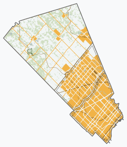
Bolton (2021 population 26,795)[1] is an unincorporated town that is the most populous community in the town of Caledon, Ontario, Canada, in the Regional Municipality of Peel. It is located beside the Humber River, approximately 50 kilometres northwest of Toronto. In regional documents, it is referred to as a 'Rural Service Centre'.[2] It has 26,795 residents in 9,158 total dwellings.[3] The downtown area that historically defined the village is in a valley, through which flows the Humber River. The village extends on either side of the valley to the north and south.
- ^ a b c "Bolton, Ontario (Population Centre)". Census Profile, Canada 2021 Census. Statistics Canada. 9 February 2022. Retrieved 12 February 2022.
- ^ "Bolton Residential Expansion Study". Town of Caledon. Retrieved 4 October 2017.
- ^ (Town of Caledon Population Distribution - June 30, 2006 - http://www.town.caledon.on.ca/contentc/townhall/statistics/Caledon_Population_Distribution_30JUN06.pdf Archived 2011-05-27 at the Wayback Machine)
© MMXXIII Rich X Search. We shall prevail. All rights reserved. Rich X Search

