Back مقاطعة كلارك (جورجيا) Arabic کلارک بؤلگهسی، جورجیا AZB Clarke County, Georgia BAR Кларк (окръг, Джорджия) Bulgarian ক্লার্কে কাউন্টি, জর্জিয়া BPY Clarke Gông (Georgia) CDO Кларк (гуо, Джорджи) CE Clarke County (kondado sa Tinipong Bansa, Georgia) CEB Clarke County, Georgia Welsh Clarke County (Georgia) German
Clarke County | |
|---|---|
 Clarke County Courthouse in Athens | |
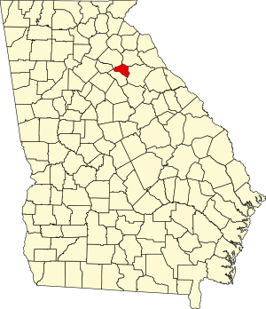
 Location within the U.S. state of Georgia | |
 Georgia's location within the U.S. | |
| Coordinates: 33°57′20″N 83°23′00″W / 33.955464°N 83.383245°W | |
| Country | |
| State | |
| Founded | 1801 |
| Named for | Elijah Clarke |
| Seat | Athens |
| Largest city | Athens |
| Area | |
| • Total | 121 sq mi (310 km2) |
| • Land | 119 sq mi (310 km2) |
| • Water | 1.8 sq mi (5 km2) 1.5% |
| Population (2020) | |
| • Total | 128,671 |
| • Estimate (2023) | 129,933 |
| • Density | 1,100/sq mi (410/km2) |
| Time zone | UTC−5 (Eastern) |
| • Summer (DST) | UTC−4 (EDT) |
| Congressional districts | 9th, 10th |
| Website | accgov.com |
Clarke County is located in the northeastern part of the U.S. state of Georgia. As of the 2020 census, the population was 128,671.[1] Its county seat is Athens,[2] with which it is a consolidated city-county. Clarke County is included in the Athens-Clarke County, GA Metropolitan Statistical Area, which is also included in the Atlanta-Athens-Clarke County-Sandy Springs, GA Combined Statistical Area.
- ^ "Census - Geography Profile: Clarke County, Georgia". United States Census Bureau. Retrieved December 26, 2022.
- ^ "Find a County". National Association of Counties. Archived from the original on May 31, 2011. Retrieved June 7, 2011.
© MMXXIII Rich X Search. We shall prevail. All rights reserved. Rich X Search
