Back مقاطعة والتون (جورجيا) Arabic والتون بؤلگهسی، جورجیا AZB Walton County, Georgia BAR Уолтън (окръг, Джорджия) Bulgarian ৱালটন কাউন্টি, জর্জিয়া BPY Walton Gông (Georgia) CDO Уолтон (гуо, Джорджи) CE Walton County (kondado sa Tinipong Bansa, Georgia) CEB Walton County, Georgia Welsh Walton County (Georgia) German
Walton County | |
|---|---|
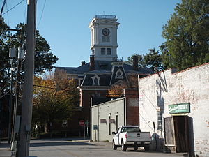
 Walton County courthouse in Monroe | |
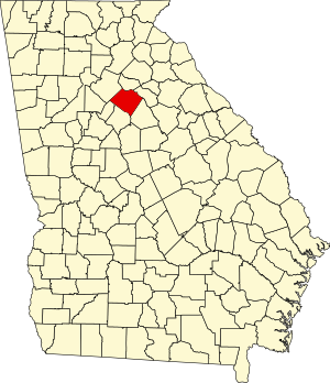
 Location within the U.S. state of Georgia | |
 Georgia's location within the U.S. | |
| Coordinates: 33°47′N 83°44′W / 33.78°N 83.74°W | |
| Country | |
| State | |
| Founded | December 22, 1818 |
| Named for | George Walton |
| Seat | Monroe |
| Largest city | Monroe |
| Area | |
| • Total | 330 sq mi (900 km2) |
| • Land | 326 sq mi (840 km2) |
| • Water | 4.3 sq mi (11 km2) 1.3% |
| Population (2020) | |
| • Total | 96,673 |
| • Density | 297/sq mi (115/km2) |
| Time zone | UTC−5 (Eastern) |
| • Summer (DST) | UTC−4 (EDT) |
| Congressional district | 10th |
| Website | waltoncountyga.gov |
Walton County is a county located in the Middle Georgia portion of the U.S. - State of Georgia. As of the 2020 census, the population was 96,673.[1] It is located about 30 miles east of the state capital, the city of Atlanta. Monroe is the county seat; Loganville is another major city.[2]
Walton County is part of the Atlanta-Sandy Springs-Roswell, GA Metropolitan Statistical Area.
- ^ "Census - Geography Profile: Walton County, Georgia". United States Census Bureau. Retrieved December 29, 2022.
- ^ "Find a County". National Association of Counties. Retrieved June 7, 2011.
© MMXXIII Rich X Search. We shall prevail. All rights reserved. Rich X Search

